Zalamea geodata
Zalamea (Jalisco) is a populated place; located in Mexico in America/Mexico_City (GMT-6) time zone. With population of 2,148 people, there are 4085 cities with bigger population in this country. Compared to other cities in Mexico, 63.8% of cities are located further ↓South; 84.1% of cities are located further →East and 52.8% of cities have lower elevation than Zalamea. Note1


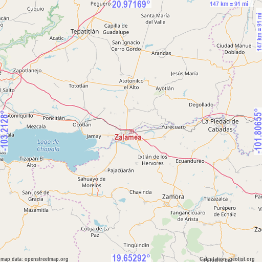
Zalamea GPS coordinates[2]
20° 18' 49.356" North, 102° 30' 34.812" West
| Map corner | latitude | longitude |
|---|---|---|
| Upper-left | 20.97169°, | -103.2128° |
| Center: | 20.31371°, | -102.50967° |
| Lower-right: | 19.65292°, | -101.80655° |
| Map W x H: | 146.6×146.6 km | = 91.1×91.1mi |
| max Lat: | 32.7° ⇑36.2% North |
| Zalamea: | 20.31371° |
| min Lat: | ⇓63.8% South 14.53588° |
| min Long | Zalamea | max Long |
| -117.105° | -102.50967° | -86.73105° |
| W 15.9%⇐ | ⇒84.1% E |
Elevation
Elevation of Zalamea is 1537 m = 5043 ft, and this is 283.3 m = 929 ft above average elevation for this country.
| Max E: |
3497 m = 11473 ft | 47.2% |
| Zalamea | 1537 m 5043 ft | |
| Avg. | 1253.7 m = 4113 ft | |
Min E: |
-1 m = -3 ft | 52.8% |
See also: Mexico elevation on elevation.city.
Geographical zone
Zalamea is located in North Torrid zone (between Equator and Tropic of Cancer). Distance of this Northern Tropic circle is 347.2 km =215.7 mi to North.| Distance of | km | miles | from Zalamea |
|---|---|---|---|
| North Pole | 7748.4 | 4814.6 | to North |
| Arctic Circle | 5142.5 | 3195.4 | to North |
| Tropic Cancer | 347.2 | 215.7 | to North |
| Equator | 2258.7 | 1403.5 | to South |


Nearby cities:
15 places around Zalamea: (largest is in red/bold)
• Briseñas de Matamoros
7.4 km =4.6 mi,  227°
227°
• El Alvareño
7.7 km =4.8 mi,  100°
100°
• El Cuenqueño
5.6 km =3.5 mi,  74°
74°
• El Loreto Occidental
5.1 km =3.2 mi,  51°
51°
• El Mirto
6 km =3.7 mi,  321°
321°
• La Barca
4.7 km =2.9 mi, 232°
• La Paz de Ordaz
4.1 km =2.5 mi,  327°
327°
• La Puerta de Guamúchil
3.7 km =2.3 mi,  293°
293°
• Paso de Hidalgo (Paso de Álamos)
5.9 km =3.7 mi,  219°
219°
• San Antonio de Rivas
9.4 km =5.8 mi,  64°
64°
• San Francisco de Rivas
7.2 km =4.5 mi, 294°
• San José de las Moras
8.8 km =5.5 mi,  279°
279°
• San Pedro de Ruíz
7 km =4.3 mi,  245°
245°
• San Ramón
7.2 km =4.5 mi, 50°
• Vista Hermosa de Negrete
5.9 km =3.7 mi,  142°
142°
Sources, notices
• [Note1] Compared only with cities in Mexico existing in our database
• [Src1] Map data: © OpenStreetMap contributors (CC-BY-SA)
• [Src2] Other city data from geonames.org with taken over terms of usage.
• [Src3] Geographical zone / Annual Mean Temperature by Robert A. Rohde @ Wikipedia
