Huáscato geodata
Huáscato (Jalisco) is a populated place; located in Mexico in America/Mexico_City (GMT-6) time zone. With population of 1,561 people, there are 5529 cities with bigger population in this country. Compared to other cities in Mexico, 67.4% of cities are located further ↓South; 82.3% of cities are located further →East and 55.9% of cities have lower elevation than Huáscato. Note1


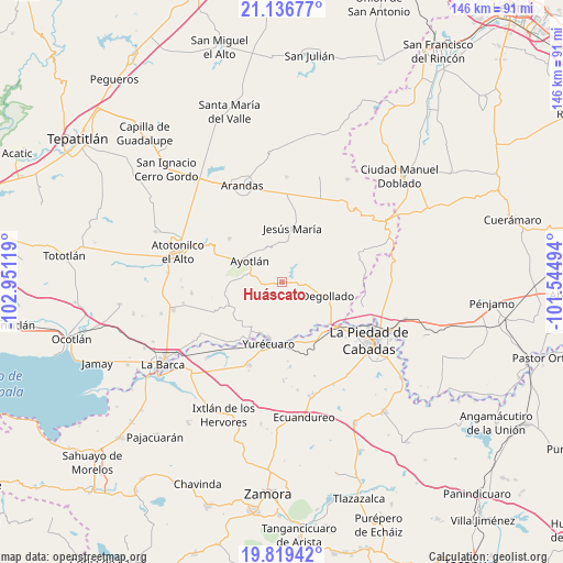
Huáscato GPS coordinates[2]
20° 28' 46.236" North, 102° 14' 53.016" West
| Map corner | latitude | longitude |
|---|---|---|
| Upper-left | 21.13677°, | -102.95119° |
| Center: | 20.47951°, | -102.24806° |
| Lower-right: | 19.81942°, | -101.54494° |
| Map W x H: | 146.5×146.5 km | = 91×91mi |
| max Lat: | 32.7° ⇑32.6% North |
| Huáscato: | 20.47951° |
| min Lat: | ⇓67.4% South 14.53588° |
| min Long | Huáscato | max Long |
| -117.105° | -102.24806° | -86.73105° |
| W 17.7%⇐ | ⇒82.3% E |
Elevation
Elevation of Huáscato is 1617 m = 5305 ft, and this is 363.3 m = 1192 ft above average elevation for this country.
| Max E: |
3497 m = 11473 ft | 44.1% |
| Huáscato | 1617 m 5305 ft | |
| Avg. | 1253.7 m = 4113 ft | |
Min E: |
-1 m = -3 ft | 55.9% |
See also: Mexico elevation on elevation.city.
Geographical zone
Huáscato is located in North Torrid zone (between Equator and Tropic of Cancer). Distance of this Northern Tropic circle is 328.8 km =204.3 mi to North.| Distance of | km | miles | from Huáscato |
|---|---|---|---|
| North Pole | 7730 | 4803.2 | to North |
| Arctic Circle | 5124.1 | 3184 | to North |
| Tropic Cancer | 328.8 | 204.3 | to North |
| Equator | 2277.1 | 1414.9 | to South |


Nearby cities:
15 places around Huáscato: (largest is in red/bold)
• Ayotlán
9.8 km =6.1 mi,  304°
304°
• Buenos Aires
13.1 km =8.1 mi,  144°
144°
• Cañada de San Ignacio
13.6 km =8.5 mi,  306°
306°
• Degollado
10.3 km =6.4 mi,  97°
97°
• El Castillo
12.8 km =8 mi,  164°
164°
• El Maluco
6.1 km =3.8 mi,  251°
251°
• El Mezquite Grande
13.9 km =8.6 mi, 161°
• Jesús María
14.3 km =8.9 mi,  10°
10°
• La Isla
10.5 km =6.5 mi,  274°
274°
• La Noria
14.1 km =8.8 mi,  213°
213°
• La Ribera
14.9 km =9.3 mi,  193°
193°
• Los Robles
13.7 km =8.5 mi, 5°
• San Jerónimo
13.1 km =8.1 mi,  226°
226°
• Santa Elena de la Cruz
13.6 km =8.5 mi, 225°
• Santa Rita
15.4 km =9.6 mi, 254°
Sources, notices
• [Note1] Compared only with cities in Mexico existing in our database
• [Src1] Map data: © OpenStreetMap contributors (CC-BY-SA)
• [Src2] Other city data from geonames.org with taken over terms of usage.
• [Src3] Geographical zone / Annual Mean Temperature by Robert A. Rohde @ Wikipedia
