Hermosillo geodata
Hermosillo (Sonora) is a seat of a first-order administrative division; located in Mexico in America/Hermosillo (GMT-7) time zone. With population of 715,061 people, there are 18 cities with bigger population in this country. Compared to other cities in Mexico, 98.1% of cities are located further ↓South; 98.6% of cities are located further →East and 75.3% of cities have higher elevation than Hermosillo. Note1


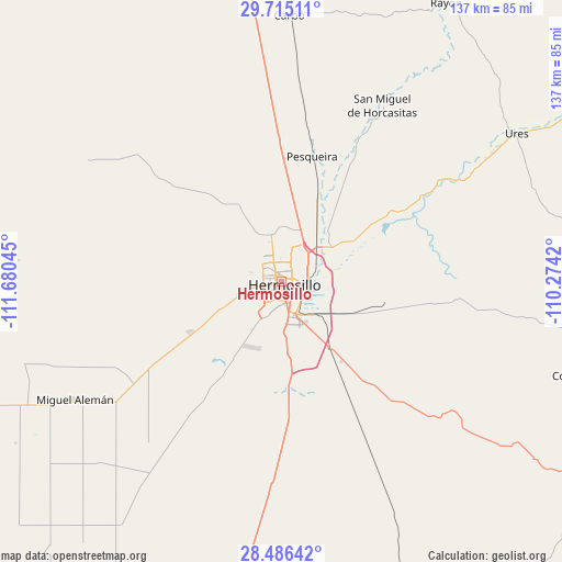
Hermosillo GPS coordinates[2]
29° 6' 9.36" North, 110° 58' 38.352" West
| Map corner | latitude | longitude |
|---|---|---|
| Upper-left | 29.71511°, | -111.68045° |
| Center: | 29.1026°, | -110.97732° |
| Lower-right: | 28.48642°, | -110.2742° |
| Map W x H: | 136.6×136.6 km | = 84.9×84.9mi |
| max Lat: | 32.7° ⇑1.9% North |
| Hermosillo: | 29.1026° |
| min Lat: | ⇓98.1% South 14.53588° |
| min Long | Hermosillo | max Long |
| -117.105° | -110.97732° | -86.73105° |
| W 1.4%⇐ | ⇒98.6% E |
Elevation
Elevation of Hermosillo is 212 m = 696 ft, and this is 1041.7 m = 3418 ft below average elevation for this country.
| Max E: |
3497 m = 11473 ft | 75.3% |
| Avg. | 1253.7 m = 4113 ft | |
| Hermosillo | 212 m = 696 ft | |
Min E: |
-1 m = -3 ft | 24.7% |
See also: Hermosillo elevation on elevation.city.
Geographical zone
Hermosillo is located in North temperate zone (between Tropic of Cancer and the Arctic Circle). Distance of this Northern Tropic circle is 630 km =391.5 mi to South.| Distance of | km | miles | from Hermosillo |
|---|---|---|---|
| North Pole | 6771.2 | 4207.4 | to North |
| Arctic Circle | 4165.3 | 2588.2 | to North |
| Tropic Cancer | 630 | 391.5 | to South |
| Equator | 3235.9 | 2010.7 | to South |


Nearby cities:
15 places around Hermosillo: (largest is in red/bold)
• Alejandro Carrillo Marcor
40.6 km =25.2 mi,  238°
238°
• Carbo
64.6 km =40.1 mi,  1°
1°
• El Alamito Buenavista
14.7 km =9.1 mi,  55°
55°
• El Triunfo
52.5 km =32.6 mi, 237°
• Estación Zamora
19.7 km =12.2 mi,  26°
26°
• Guadalupe
60 km =37.3 mi, 58°
• La Colorada
51 km =31.7 mi,  130°
130°
• La Victoria
8.7 km =5.4 mi,  75°
75°
• Las Mercedes [Agropecuaria]
29.2 km =18.1 mi, 4°
• Miguel Alemán (La Doce)
56.7 km =35.2 mi, 239°
• Molino de Camou
24.1 km =15 mi, 62°
• Pesqueira
31.8 km =19.8 mi,  14°
14°
• San Miguel de Horcasitas
49.3 km =30.6 mi, 29°
• Santa Inés Uno (El Capitán)
51.8 km =32.2 mi,  266°
266°
• Ures
67.6 km =42 mi, 57°
Sources, notices
• [Note1] Compared only with cities in Mexico existing in our database
• [Src1] Map data: © OpenStreetMap contributors (CC-BY-SA)
• [Src2] Other city data from geonames.org with taken over terms of usage.
• [Src3] Geographical zone / Annual Mean Temperature by Robert A. Rohde @ Wikipedia
