Carbo geodata
Carbo (Sonora) is a seat of a second-order administrative division; located in Mexico in America/Hermosillo (GMT-7) time zone. With population of 4,516 people, there are 2036 cities with bigger population in this country. Compared to other cities in Mexico, 98.3% of cities are located further ↓South; 98.6% of cities are located further →East and 69% of cities have higher elevation than Carbo. Note1


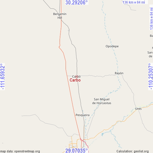
Carbo GPS coordinates[2]
29° 40' 59.016" North, 110° 57' 22.284" West
| Map corner | latitude | longitude |
|---|---|---|
| Upper-left | 30.29206°, | -111.65932° |
| Center: | 29.68306°, | -110.95619° |
| Lower-right: | 29.07035°, | -110.25307° |
| Map W x H: | 135.8×135.8 km | = 84.4×84.4mi |
| max Lat: | 32.7° ⇑1.7% North |
| Carbo: | 29.68306° |
| min Lat: | ⇓98.3% South 14.53588° |
| min Long | Carbo | max Long |
| -117.105° | -110.95619° | -86.73105° |
| W 1.4%⇐ | ⇒98.6% E |
Elevation
Elevation of Carbo is 468 m = 1535 ft, and this is 785.7 m = 2578 ft below average elevation for this country.
| Max E: |
3497 m = 11473 ft | 69% |
| Avg. | 1253.7 m = 4113 ft | |
| Carbo | 468 m = 1535 ft | |
Min E: |
-1 m = -3 ft | 31% |
See also: Mexico elevation on elevation.city.
Geographical zone
Carbo is located in North temperate zone (between Tropic of Cancer and the Arctic Circle). Distance of this Northern Tropic circle is 694.5 km =431.5 mi to South.| Distance of | km | miles | from Carbo |
|---|---|---|---|
| North Pole | 6706.6 | 4167.3 | to North |
| Arctic Circle | 4100.7 | 2548.1 | to North |
| Tropic Cancer | 694.5 | 431.5 | to South |
| Equator | 3300.4 | 2050.8 | to South |


Nearby cities:
15 places around Carbo: (largest is in red/bold)
• Benjamín Hill
56.1 km =34.9 mi,  344°
344°
• El Alamito Buenavista
57 km =35.4 mi,  169°
169°
• Estación Zamora
47.4 km =29.5 mi, 171°
• Guadalupe
59.2 km =36.8 mi,  124°
124°
• Hermosillo
64.6 km =40.1 mi,  181°
181°
• La Victoria
62.7 km =39 mi, 174°
• Las Mercedes [Agropecuaria]
35.5 km =22.1 mi, 179°
• Molino de Camou
56.6 km =35.2 mi,  160°
160°
• Opodepe
41.5 km =25.8 mi,  49°
49°
• Pesqueira
34.2 km =21.3 mi, 170°
• Querobabi
41.4 km =25.7 mi,  350°
350°
• Rayón
37.7 km =23.4 mi,  85°
85°
• San Felipe de Jesús
72.1 km =44.8 mi,  74°
74°
• San Miguel de Horcasitas
31.2 km =19.4 mi,  134°
134°
• Ures
61.9 km =38.5 mi, 117°
Sources, notices
• [Note1] Compared only with cities in Mexico existing in our database
• [Src1] Map data: © OpenStreetMap contributors (CC-BY-SA)
• [Src2] Other city data from geonames.org with taken over terms of usage.
• [Src3] Geographical zone / Annual Mean Temperature by Robert A. Rohde @ Wikipedia
