El Saucillo geodata
El Saucillo (Guanajuato) is a populated place; located in Mexico in America/Mexico_City (GMT-6) time zone. With population of 668 people, there are 12987 cities with bigger population in this country. Compared to other cities in Mexico, 71.6% of cities are located further ↓South; 79.1% of cities are located further →East and 60.8% of cities have lower elevation than El Saucillo. Note1


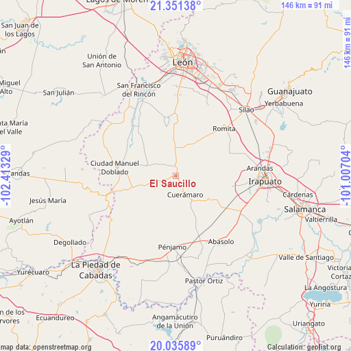
El Saucillo GPS coordinates[2]
20° 41' 42.216" North, 101° 42' 36.576" West
| Map corner | latitude | longitude |
|---|---|---|
| Upper-left | 21.35138°, | -102.41329° |
| Center: | 20.69506°, | -101.71016° |
| Lower-right: | 20.03589°, | -101.00704° |
| Map W x H: | 146.3×146.3 km | = 90.9×90.9mi |
| max Lat: | 32.7° ⇑28.4% North |
| El Saucillo: | 20.69506° |
| min Lat: | ⇓71.6% South 14.53588° |
| min Long | El Saucillo | max Long |
| -117.105° | -101.71016° | -86.73105° |
| W 20.9%⇐ | ⇒79.1% E |
Elevation
Elevation of El Saucillo is 1740 m = 5709 ft, and this is 486.3 m = 1595 ft above average elevation for this country.
| Max E: |
3497 m = 11473 ft | 39.2% |
| El Saucillo | 1740 m 5709 ft | |
| Avg. | 1253.7 m = 4113 ft | |
Min E: |
-1 m = -3 ft | 60.8% |
See also: Mexico elevation on elevation.city.
Geographical zone
El Saucillo is located in North Torrid zone (between Equator and Tropic of Cancer). Distance of this Northern Tropic circle is 304.8 km =189.4 mi to North.| Distance of | km | miles | from El Saucillo |
|---|---|---|---|
| North Pole | 7706 | 4788.3 | to North |
| Arctic Circle | 5100.1 | 3169.1 | to North |
| Tropic Cancer | 304.8 | 189.4 | to North |
| Equator | 2301.1 | 1429.8 | to South |


Nearby cities:
15 places around El Saucillo: (largest is in red/bold)
• Cerrito de Agua Caliente
14.5 km =9 mi,  116°
116°
• Cuerámaro
8.7 km =5.4 mi,  153°
153°
• El Platanar
9.5 km =5.9 mi,  174°
174°
• Galera de la Grulla
10.3 km =6.4 mi,  129°
129°
• La Joya de Calvillo
12.1 km =7.5 mi,  60°
60°
• Los Amoles
14.1 km =8.8 mi,  37°
37°
• Monte de Hoyos
14.1 km =8.8 mi,  21°
21°
• Puerta de la Reserva
5.9 km =3.7 mi,  164°
164°
• Puerto de la Cruz
12.9 km =8 mi,  86°
86°
• San Antonio Cerro Prieto
7.3 km =4.5 mi, 61°
• San Isidro Ojo de Agua
10.7 km =6.6 mi,  29°
29°
• San José de Otates
13.4 km =8.3 mi,  316°
316°
• San Juan de la Puerta
4 km =2.5 mi,  354°
354°
• Santa Efigenia
12.3 km =7.6 mi, 15°
• Tupataro
12.9 km =8 mi, 149°
Sources, notices
• [Note1] Compared only with cities in Mexico existing in our database
• [Src1] Map data: © OpenStreetMap contributors (CC-BY-SA)
• [Src2] Other city data from geonames.org with taken over terms of usage.
• [Src3] Geographical zone / Annual Mean Temperature by Robert A. Rohde @ Wikipedia
