Caballerías (Caballería Villa Hidalgo) geodata
Caballerías (Caballería Villa Hidalgo) (Zacatecas) is a populated place; located in Mexico in America/Mexico_City (GMT-6) time zone. With population of 716 people, there are 12166 cities with bigger population in this country. Compared to other cities in Mexico, 86.1% of cities are located further ↓South; 78.7% of cities are located further →East and 86.9% of cities have lower elevation than Caballerías (Caballería Villa Hidalgo). Note1
Current local time in Caballerías (Caballería Villa Hidalgo):
08:38 AM, WednesdayDifference from your time zone: hours


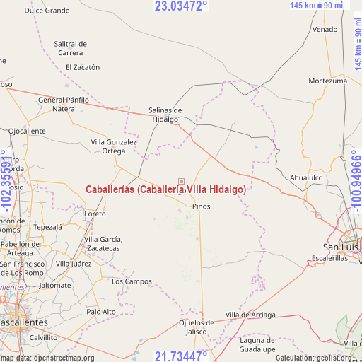
Caballerías (Caballería Villa Hidalgo) GPS coordinates[2]
22° 23' 9.996" North, 101° 39' 10.008" West
| Map corner | latitude | longitude |
|---|---|---|
| Upper-left | 23.03472°, | -102.35591° |
| Center: | 22.38611°, | -101.65278° |
| Lower-right: | 21.73447°, | -100.94966° |
| Map W x H: | 144.6×144.6 km | = 89.9×89.9mi |
| max Lat: | 32.7° ⇑13.9% North |
| Caballerías (Caballería Villa Hidalgo): | 22.38611° |
| min Lat: | ⇓86.1% South 14.53588° |
| min Long | Caballerías (C | max Long |
| -117.105° | -101.65278° | -86.73105° |
| W 21.3%⇐ | ⇒78.7% E |
Elevation
Elevation of Caballerías (Caballería Villa Hidalgo) is 2307 m = 7569 ft, and this is 1053.3 m = 3456 ft above average elevation for this country.
| Max E: |
3497 m = 11473 ft | 13.1% |
| Caballerías (Caballería Villa Hidalgo) | 2307 m 7569 ft | |
| Avg. | 1253.7 m = 4113 ft | |
Min E: |
-1 m = -3 ft | 86.9% |
See also: Mexico elevation on elevation.city.
Geographical zone
Caballerías (Caballería Villa Hidalgo) is located in North Torrid zone (between Equator and Tropic of Cancer). Distance of this Northern Tropic circle is 116.8 km =72.6 mi to North.| Distance of | km | miles | from Caballerías (Caballería Villa Hidalgo) |
|---|---|---|---|
| North Pole | 7518 | 4671.5 | to North |
| Arctic Circle | 4912.1 | 3052.2 | to North |
| Tropic Cancer | 116.8 | 72.6 | to North |
| Equator | 2489.1 | 1546.7 | to South |


Nearby cities:
15 places around Caballerías (Caballería Villa Hidalgo): (largest is in red/bold)
• Canoas
10.9 km =6.8 mi,  268°
268°
• El Chino
7.4 km =4.6 mi,  184°
184°
• El Fraile
13.3 km =8.3 mi,  221°
221°
• El Refugio
11.2 km =7 mi,  260°
260°
• El Salitre
13.3 km =8.3 mi,  278°
278°
• El Tepetate
5.3 km =3.3 mi, 278°
• Estancia de Guadalupe
11.7 km =7.3 mi, 182°
• La Ballena
9.6 km =6 mi,  323°
323°
• La Lobeña
11.6 km =7.2 mi,  205°
205°
• La Pendencia
9.8 km =6.1 mi,  53°
53°
• Pinos
12.8 km =8 mi,  141°
141°
• Presa de Valenzuela
4.6 km =2.9 mi,  204°
204°
• Rancho Nuevo de Morelos (De Guadalupe)
14.5 km =9 mi,  249°
249°
• San Andrés
6.7 km =4.2 mi,  65°
65°
• Villa Hidalgo
7 km =4.3 mi,  242°
242°
Sources, notices
• [Note1] Compared only with cities in Mexico existing in our database
• [Src1] Map data: © OpenStreetMap contributors (CC-BY-SA)
• [Src2] Other city data from geonames.org with taken over terms of usage.
• [Src3] Geographical zone / Annual Mean Temperature by Robert A. Rohde @ Wikipedia
