Nuevo Lindero geodata
Nuevo Lindero (Guanajuato) is a populated place; located in Mexico in America/Mexico_City (GMT-6) time zone. With population of 896 people, there are 9729 cities with bigger population in this country. Compared to other cities in Mexico, 75.9% of cities are located further ↓South; 78.5% of cities are located further →East and 62.8% of cities have lower elevation than Nuevo Lindero. Note1


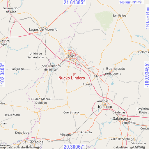
Nuevo Lindero GPS coordinates[2]
20° 57' 31.32" North, 101° 38' 15.612" West
| Map corner | latitude | longitude |
|---|---|---|
| Upper-left | 21.61385°, | -102.3408° |
| Center: | 20.9587°, | -101.63767° |
| Lower-right: | 20.30067°, | -100.93455° |
| Map W x H: | 146×146 km | = 90.7×90.7mi |
| max Lat: | 32.7° ⇑24.1% North |
| Nuevo Lindero: | 20.9587° |
| min Lat: | ⇓75.9% South 14.53588° |
| min Long | Nuevo Lindero | max Long |
| -117.105° | -101.63767° | -86.73105° |
| W 21.5%⇐ | ⇒78.5% E |
Elevation
Elevation of Nuevo Lindero is 1774 m = 5820 ft, and this is 520.3 m = 1707 ft above average elevation for this country.
| Max E: |
3497 m = 11473 ft | 37.2% |
| Nuevo Lindero | 1774 m 5820 ft | |
| Avg. | 1253.7 m = 4113 ft | |
Min E: |
-1 m = -3 ft | 62.8% |
See also: Mexico elevation on elevation.city.
Geographical zone
Nuevo Lindero is located in North Torrid zone (between Equator and Tropic of Cancer). Distance of this Northern Tropic circle is 275.5 km =171.2 mi to North.| Distance of | km | miles | from Nuevo Lindero |
|---|---|---|---|
| North Pole | 7676.7 | 4770.1 | to North |
| Arctic Circle | 5070.8 | 3150.8 | to North |
| Tropic Cancer | 275.5 | 171.2 | to North |
| Equator | 2330.4 | 1448 | to South |


Nearby cities:
15 places around Nuevo Lindero: (largest is in red/bold)
• Barretos
2.2 km =1.4 mi,  193°
193°
• El CERESO
8.9 km =5.5 mi,  322°
322°
• El Camaleón
7.9 km =4.9 mi,  176°
176°
• El Jaguey
4.9 km =3 mi, 175°
• El Resplandor
5.9 km =3.7 mi,  34°
34°
• Guadalupe Victoria
9 km =5.6 mi,  41°
41°
• La Arcina
3.1 km =1.9 mi,  128°
128°
• La Sardina
9.1 km =5.7 mi,  197°
197°
• Los Ramírez
6.8 km =4.2 mi,  354°
354°
• Plan Guanajuato (La Sandía)
7.4 km =4.6 mi,  236°
236°
• Plan Libertador
4.6 km =2.9 mi,  262°
262°
• Rancho Nuevo de la Luz
0.9 km =0.6 mi,  296°
296°
• San Carlos del Jagüey
5.4 km =3.4 mi, 177°
• San Cristóbal
6.8 km =4.2 mi,  288°
288°
• San Francisco de Durán
5.5 km =3.4 mi,  19°
19°
Sources, notices
• [Note1] Compared only with cities in Mexico existing in our database
• [Src1] Map data: © OpenStreetMap contributors (CC-BY-SA)
• [Src2] Other city data from geonames.org with taken over terms of usage.
• [Src3] Geographical zone / Annual Mean Temperature by Robert A. Rohde @ Wikipedia
