Rancho Nuevo de la Luz geodata
Rancho Nuevo de la Luz (Guanajuato) is a populated place; located in Mexico in America/Mexico_City (GMT-6) time zone. With population of 1,025 people, there are 8501 cities with bigger population in this country. Compared to other cities in Mexico, 75.9% of cities are located further ↓South; 78.6% of cities are located further →East and 62.8% of cities have lower elevation than Rancho Nuevo de la Luz. Note1
Current local time in Rancho Nuevo de la Luz:
06:45 AM, WednesdayDifference from your time zone: hours


Rancho Nuevo de la Luz GPS coordinates[2]
20° 57' 44.856" North, 101° 38' 44.628" West
| Map corner | latitude | longitude |
|---|---|---|
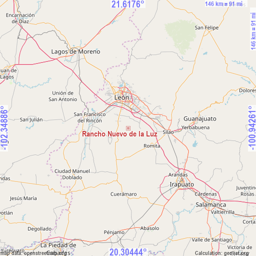
| Upper-left | 21.6176°, | -102.34886° |
| Center: | 20.96246°, | -101.64573° |
| Lower-right: | 20.30444°, | -100.94261° |
| Map W x H: | 146×146 km | = 90.7×90.7mi |
| max Lat: | 32.7° ⇑24.1% North |
| Rancho Nuevo de la Luz: | 20.96246° |
| min Lat: | ⇓75.9% South 14.53588° |
| min Long | Rancho Nuevo de | max Long |
| -117.105° | -101.64573° | -86.73105° |
| W 21.4%⇐ | ⇒78.6% E |
Elevation
Elevation of Rancho Nuevo de la Luz is 1774 m = 5820 ft, and this is 520.3 m = 1707 ft above average elevation for this country.
| Max E: |
3497 m = 11473 ft | 37.2% |
| Rancho Nuevo de la Luz | 1774 m 5820 ft | |
| Avg. | 1253.7 m = 4113 ft | |
Min E: |
-1 m = -3 ft | 62.8% |
See also: Mexico elevation on elevation.city.
Geographical zone
Rancho Nuevo de la Luz is located in North Torrid zone (between Equator and Tropic of Cancer). Distance of this Northern Tropic circle is 275.1 km =170.9 mi to North.| Distance of | km | miles | from Rancho Nuevo de la Luz |
|---|---|---|---|
| North Pole | 7676.3 | 4769.8 | to North |
| Arctic Circle | 5070.4 | 3150.6 | to North |
| Tropic Cancer | 275.1 | 170.9 | to North |
| Equator | 2330.8 | 1448.3 | to South |


Nearby cities:
15 places around Rancho Nuevo de la Luz: (largest is in red/bold)
• Barretos
2.6 km =1.6 mi,  173°
173°
• El CERESO
8 km =5 mi,  325°
325°
• El Camaleón
8.4 km =5.2 mi, 170°
• El Jaguey
5.4 km =3.4 mi, 167°
• El Resplandor
6.1 km =3.8 mi,  43°
43°
• Guadalupe Victoria
9.3 km =5.8 mi,  47°
47°
• La Arcina
4 km =2.5 mi,  125°
125°
• La Sardina
9.2 km =5.7 mi,  192°
192°
• Los Ramírez
6.3 km =3.9 mi,  1°
1°
• Nuevo Lindero
0.9 km =0.6 mi,  116°
116°
• Plan Guanajuato (La Sandía)
7 km =4.3 mi,  229°
229°
• Plan Libertador
3.8 km =2.4 mi,  254°
254°
• San Carlos del Jagüey
5.9 km =3.7 mi, 169°
• San Cristóbal
5.9 km =3.7 mi,  286°
286°
• San Francisco de Durán
5.4 km =3.4 mi,  29°
29°
Sources, notices
• [Note1] Compared only with cities in Mexico existing in our database
• [Src1] Map data: © OpenStreetMap contributors (CC-BY-SA)
• [Src2] Other city data from geonames.org with taken over terms of usage.
• [Src3] Geographical zone / Annual Mean Temperature by Robert A. Rohde @ Wikipedia
