Cucurpe geodata
Cucurpe (Sonora) is a seat of a second-order administrative division; located in Mexico in America/Hermosillo (GMT-7) time zone. With population of 588 people, there are 14598 cities with bigger population in this country. Compared to other cities in Mexico, 98.6% of cities are located further ↓South; 98.5% of cities are located further →East and 62.4% of cities have higher elevation than Cucurpe. Note1


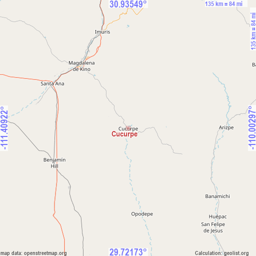
Cucurpe GPS coordinates[2]
30° 19' 49.764" North, 110° 42' 21.924" West
| Map corner | latitude | longitude |
|---|---|---|
| Upper-left | 30.93549°, | -111.40922° |
| Center: | 30.33049°, | -110.70609° |
| Lower-right: | 29.72173°, | -110.00297° |
| Map W x H: | 135×135 km | = 83.9×83.9mi |
| max Lat: | 32.7° ⇑1.4% North |
| Cucurpe: | 30.33049° |
| min Lat: | ⇓98.6% South 14.53588° |
| min Long | Cucurpe | max Long |
| -117.105° | -110.70609° | -86.73105° |
| W 1.5%⇐ | ⇒98.5% E |
Elevation
Elevation of Cucurpe is 860 m = 2822 ft, and this is 393.7 m = 1292 ft below average elevation for this country.
| Max E: |
3497 m = 11473 ft | 62.4% |
| Avg. | 1253.7 m = 4113 ft | |
| Cucurpe | 860 m = 2822 ft | |
Min E: |
-1 m = -3 ft | 37.6% |
See also: Mexico elevation on elevation.city.
Geographical zone
Cucurpe is located in North temperate zone (between Tropic of Cancer and the Arctic Circle). Distance of this Northern Tropic circle is 766.5 km =476.3 mi to South.| Distance of | km | miles | from Cucurpe |
|---|---|---|---|
| North Pole | 6634.6 | 4122.5 | to North |
| Arctic Circle | 4028.7 | 2503.3 | to North |
| Tropic Cancer | 766.5 | 476.3 | to South |
| Equator | 3372.4 | 2095.5 | to South |


Nearby cities:
15 places around Cucurpe: (largest is in red/bold)
• Arizpe
51.8 km =32.2 mi,  89°
89°
• Benjamín Hill
43.1 km =26.8 mi,  245°
245°
• Campo Carretero
51 km =31.7 mi,  343°
343°
• El Claro
49.5 km =30.8 mi,  285°
285°
• El Crucero
51.7 km =32.1 mi, 342°
• El Tasicuri
43 km =26.7 mi,  329°
329°
• Estación Llano
38.3 km =23.8 mi,  275°
275°
• Imuris
52.8 km =32.8 mi,  345°
345°
• La Estación
52.2 km =32.4 mi, 342°
• Magdalena de Kino
41.2 km =25.6 mi,  323°
323°
• Opodepe
45.6 km =28.3 mi,  170°
170°
• Querobabi
43.8 km =27.2 mi,  224°
224°
• San Ignacio
45.7 km =28.4 mi, 333°
• Santa Ana
46 km =28.6 mi,  300°
300°
• Santa Ana Viejo
47.9 km =29.8 mi, 300°
Sources, notices
• [Note1] Compared only with cities in Mexico existing in our database
• [Src1] Map data: © OpenStreetMap contributors (CC-BY-SA)
• [Src2] Other city data from geonames.org with taken over terms of usage.
• [Src3] Geographical zone / Annual Mean Temperature by Robert A. Rohde @ Wikipedia
