San Ignacio geodata
San Ignacio (Sonora) is a populated place; located in Mexico in America/Hermosillo (GMT-7) time zone. With population of 1,140 people, there are 7619 cities with bigger population in this country. Compared to other cities in Mexico, 98.7% of cities are located further ↓South; 98.6% of cities are located further →East and 63.4% of cities have higher elevation than San Ignacio. Note1


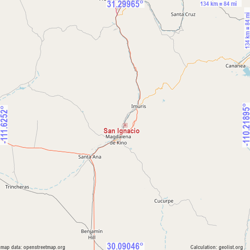
San Ignacio GPS coordinates[2]
30° 41' 49.02" North, 110° 55' 19.452" West
| Map corner | latitude | longitude |
|---|---|---|
| Upper-left | 31.29965°, | -111.6252° |
| Center: | 30.69695°, | -110.92207° |
| Lower-right: | 30.09046°, | -110.21895° |
| Map W x H: | 134.4×134.5 km | = 83.5×83.6mi |
| max Lat: | 32.7° ⇑1.3% North |
| San Ignacio: | 30.69695° |
| min Lat: | ⇓98.7% South 14.53588° |
| min Long | San Ignacio | max Long |
| -117.105° | -110.92207° | -86.73105° |
| W 1.4%⇐ | ⇒98.6% E |
Elevation
Elevation of San Ignacio is 792 m = 2598 ft, and this is 461.7 m = 1515 ft below average elevation for this country.
| Max E: |
3497 m = 11473 ft | 63.4% |
| Avg. | 1253.7 m = 4113 ft | |
| San Ignacio | 792 m = 2598 ft | |
Min E: |
-1 m = -3 ft | 36.6% |
See also: Mexico elevation on elevation.city.
Geographical zone
San Ignacio is located in North temperate zone (between Tropic of Cancer and the Arctic Circle). Distance of this Northern Tropic circle is 807.3 km =501.6 mi to South.| Distance of | km | miles | from San Ignacio |
|---|---|---|---|
| North Pole | 6593.9 | 4097.3 | to North |
| Arctic Circle | 3988 | 2478 | to North |
| Tropic Cancer | 807.3 | 501.6 | to South |
| Equator | 3413.2 | 2120.9 | to South |


Nearby cities:
15 places around San Ignacio: (largest is in red/bold)
• Campo Carretero
10.6 km =6.6 mi,  38°
38°
• Centro de Readaptación Social Nuevo
54.4 km =33.8 mi,  355°
355°
• Cucurpe
45.7 km =28.4 mi,  153°
153°
• Cíbuta
40.6 km =25.2 mi,  3°
3°
• El Claro
38.2 km =23.7 mi,  224°
224°
• El Crucero
9.7 km =6 mi,  29°
29°
• El Tasicuri
3.7 km =2.3 mi,  194°
194°
• Estación Llano
41.2 km =25.6 mi,  205°
205°
• Imuris
12.6 km =7.8 mi, 35°
• La Estación
10.1 km =6.3 mi, 28°
• La Mesa
51.7 km =32.1 mi,  354°
354°
• Magdalena de Kino
8.6 km =5.3 mi, 206°
• Santa Ana
25.6 km =15.9 mi,  227°
227°
• Santa Ana Viejo
26.6 km =16.5 mi, 231°
• Tubutama
55.9 km =34.7 mi,  291°
291°
Sources, notices
• [Note1] Compared only with cities in Mexico existing in our database
• [Src1] Map data: © OpenStreetMap contributors (CC-BY-SA)
• [Src2] Other city data from geonames.org with taken over terms of usage.
• [Src3] Geographical zone / Annual Mean Temperature by Robert A. Rohde @ Wikipedia
