La Estación geodata
La Estación (Sonora) is a populated place; located in Mexico in America/Hermosillo (GMT-7) time zone. With population of 664 people, there are 13077 cities with bigger population in this country. Compared to other cities in Mexico, 98.8% of cities are located further ↓South; 98.6% of cities are located further →East and 62.8% of cities have higher elevation than La Estación. Note1


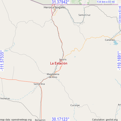
La Estación GPS coordinates[2]
30° 46' 37.992" North, 110° 52' 19.992" West
| Map corner | latitude | longitude |
|---|---|---|
| Upper-left | 31.37942°, | -111.57535° |
| Center: | 30.77722°, | -110.87222° |
| Lower-right: | 30.17123°, | -110.1691° |
| Map W x H: | 134.3×134.3 km | = 83.5×83.5mi |
| max Lat: | 32.7° ⇑1.2% North |
| La Estación: | 30.77722° |
| min Lat: | ⇓98.8% South 14.53588° |
| min Long | La Estación | max Long |
| -117.105° | -110.87222° | -86.73105° |
| W 1.4%⇐ | ⇒98.6% E |
Elevation
Elevation of La Estación is 833 m = 2733 ft, and this is 420.7 m = 1380 ft below average elevation for this country.
| Max E: |
3497 m = 11473 ft | 62.8% |
| Avg. | 1253.7 m = 4113 ft | |
| La Estación | 833 m = 2733 ft | |
Min E: |
-1 m = -3 ft | 37.2% |
See also: Mexico elevation on elevation.city.
Geographical zone
La Estación is located in North temperate zone (between Tropic of Cancer and the Arctic Circle). Distance of this Northern Tropic circle is 816.2 km =507.2 mi to South.| Distance of | km | miles | from La Estación |
|---|---|---|---|
| North Pole | 6585 | 4091.7 | to North |
| Arctic Circle | 3979.1 | 2472.5 | to North |
| Tropic Cancer | 816.2 | 507.2 | to South |
| Equator | 3422.1 | 2126.4 | to South |


Nearby cities:
15 places around La Estación: (largest is in red/bold)
• Campo Carretero
1.9 km =1.2 mi,  109°
109°
• Centro de Readaptación Social Nuevo
46.2 km =28.7 mi,  348°
348°
• Cucurpe
52.2 km =32.4 mi,  162°
162°
• Cíbuta
31.7 km =19.7 mi,  355°
355°
• El Claro
48 km =29.8 mi,  221°
221°
• El Crucero
0.5 km =0.3 mi,  180°
180°
• El Tasicuri
13.8 km =8.6 mi,  204°
204°
• Estación Llano
51.3 km =31.9 mi,  205°
205°
• Imuris
2.9 km =1.8 mi,  61°
61°
• La Mesa
43.6 km =27.1 mi, 347°
• Magdalena de Kino
18.7 km =11.6 mi, 207°
• Miguel Hidalgo
46.4 km =28.8 mi,  28°
28°
• San Ignacio
10.1 km =6.3 mi, 208°
• Santa Ana
35.3 km =21.9 mi, 221°
• Santa Ana Viejo
36.1 km =22.4 mi, 224°
Sources, notices
• [Note1] Compared only with cities in Mexico existing in our database
• [Src1] Map data: © OpenStreetMap contributors (CC-BY-SA)
• [Src2] Other city data from geonames.org with taken over terms of usage.
• [Src3] Geographical zone / Annual Mean Temperature by Robert A. Rohde @ Wikipedia
