Coyula geodata
Coyula (Jalisco) is a populated place; located in Mexico in America/Mexico_City (GMT-6) time zone. With population of 29,674 people, there are 336 cities with bigger population in this country. Compared to other cities in Mexico, 71% of cities are located further ↓South; 86.7% of cities are located further →East and 54.4% of cities have lower elevation than Coyula. Note1


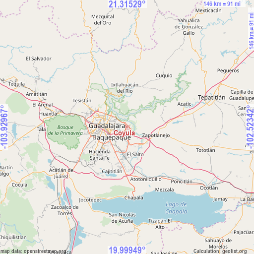
Coyula GPS coordinates[2]
20° 39' 31.716" North, 103° 13' 35.544" West
| Map corner | latitude | longitude |
|---|---|---|
| Upper-left | 21.31529°, | -103.92967° |
| Center: | 20.65881°, | -103.22654° |
| Lower-right: | 19.99949°, | -102.52342° |
| Map W x H: | 146.3×146.3 km | = 90.9×90.9mi |
| max Lat: | 32.7° ⇑29% North |
| Coyula: | 20.65881° |
| min Lat: | ⇓71% South 14.53588° |
| min Long | Coyula | max Long |
| -117.105° | -103.22654° | -86.73105° |
| W 13.3%⇐ | ⇒86.7% E |
Elevation
Elevation of Coyula is 1572 m = 5157 ft, and this is 318.3 m = 1044 ft above average elevation for this country.
| Max E: |
3497 m = 11473 ft | 45.6% |
| Coyula | 1572 m 5157 ft | |
| Avg. | 1253.7 m = 4113 ft | |
Min E: |
-1 m = -3 ft | 54.4% |
See also: Mexico elevation on elevation.city.
Geographical zone
Coyula is located in North Torrid zone (between Equator and Tropic of Cancer). Distance of this Northern Tropic circle is 308.9 km =191.9 mi to North.| Distance of | km | miles | from Coyula |
|---|---|---|---|
| North Pole | 7710 | 4790.8 | to North |
| Arctic Circle | 5104.1 | 3171.5 | to North |
| Tropic Cancer | 308.9 | 191.9 | to North |
| Equator | 2297 | 1427.3 | to South |


Nearby cities:
15 places around Coyula: (largest is in red/bold)
• Centro de Readaptación Social
12.1 km =7.5 mi,  163°
163°
• Colonia Guadalupana
10.3 km =6.4 mi,  175°
175°
• El Mirador
10.4 km =6.5 mi,  207°
207°
• El Vado
9.2 km =5.7 mi,  127°
127°
• La Punta
9.8 km =6.1 mi,  170°
170°
• Los Amiales
5 km =3.1 mi, 184°
• Matatlán
9.8 km =6.1 mi,  54°
54°
• Mismaloya (Fraccionamiento Pedregal de Santa Martha)
8.1 km =5 mi,  135°
135°
• Nuevo Israel
6.1 km =3.8 mi,  316°
316°
• Paseo Puente Viejo
10.6 km =6.6 mi, 159°
• Paseo de las Cañadas
5.1 km =3.2 mi, 144°
• Pueblos de la Barranca (El Maestranzo)
12.4 km =7.7 mi, 131°
• Residencias el Prado (Jardines del Prado)
3 km =1.9 mi,  15°
15°
• Tlaquepaque
7.2 km =4.5 mi,  254°
254°
• Tonalá
3.9 km =2.4 mi,  191°
191°
Sources, notices
• [Note1] Compared only with cities in Mexico existing in our database
• [Src1] Map data: © OpenStreetMap contributors (CC-BY-SA)
• [Src2] Other city data from geonames.org with taken over terms of usage.
• [Src3] Geographical zone / Annual Mean Temperature by Robert A. Rohde @ Wikipedia
