Joroches (Joroches Nuevo) geodata
Joroches (Joroches Nuevo) (Guanajuato) is a populated place; located in Mexico in America/Mexico_City (GMT-6) time zone. With population of 800 people, there are 10908 cities with bigger population in this country. Compared to other cities in Mexico, 64.1% of cities are located further ↓South; 77.5% of cities are located further →East and 58.3% of cities have lower elevation than Joroches (Joroches Nuevo). Note1
Current local time in Joroches (Joroches Nuevo):
12:57 AM, WednesdayDifference from your time zone: hours


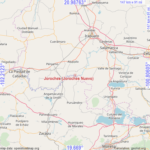
Joroches (Joroches Nuevo) GPS coordinates[2]
20° 19' 46.992" North, 101° 30' 33.012" West
| Map corner | latitude | longitude |
|---|---|---|
| Upper-left | 20.98763°, | -102.2123° |
| Center: | 20.32972°, | -101.50917° |
| Lower-right: | 19.669°, | -100.80605° |
| Map W x H: | 146.6×146.6 km | = 91.1×91.1mi |
| max Lat: | 32.7° ⇑35.9% North |
| Joroches (Joroches Nuevo): | 20.32972° |
| min Lat: | ⇓64.1% South 14.53588° |
| min Long | Joroches (Joroc | max Long |
| -117.105° | -101.50917° | -86.73105° |
| W 22.5%⇐ | ⇒77.5% E |
Elevation
Elevation of Joroches (Joroches Nuevo) is 1695 m = 5561 ft, and this is 441.3 m = 1448 ft above average elevation for this country.
| Max E: |
3497 m = 11473 ft | 41.7% |
| Joroches (Joroches Nuevo) | 1695 m 5561 ft | |
| Avg. | 1253.7 m = 4113 ft | |
Min E: |
-1 m = -3 ft | 58.3% |
See also: Mexico elevation on elevation.city.
Geographical zone
Joroches (Joroches Nuevo) is located in North Torrid zone (between Equator and Tropic of Cancer). Distance of this Northern Tropic circle is 345.5 km =214.7 mi to North.| Distance of | km | miles | from Joroches (Joroches Nuevo) |
|---|---|---|---|
| North Pole | 7746.6 | 4813.5 | to North |
| Arctic Circle | 5140.7 | 3194.3 | to North |
| Tropic Cancer | 345.5 | 214.7 | to North |
| Equator | 2260.5 | 1404.6 | to South |


Nearby cities:
15 places around Joroches (Joroches Nuevo): (largest is in red/bold)
• Cora
4.4 km =2.7 mi,  87°
87°
• Huanímaro
4.4 km =2.7 mi,  14°
14°
• Héroes de Chapultepec (Rodeo de San Antonio)
2.2 km =1.4 mi,  161°
161°
• La Calera (Nacimientos)
9.2 km =5.7 mi,  228°
228°
• La Lobera
4.5 km =2.8 mi,  314°
314°
• La Soledad de Santa Ana
7.2 km =4.5 mi, 156°
• Las Raíces
8.5 km =5.3 mi,  70°
70°
• Los Corrales
6.8 km =4.2 mi,  256°
256°
• Monte Blanco
3.4 km =2.1 mi,  325°
325°
• Otates
8.4 km =5.2 mi,  19°
19°
• Rancho de Guadalupe (El Gato)
5.5 km =3.4 mi,  287°
287°
• Rincón de Martínez
7.2 km =4.5 mi,  268°
268°
• Salitre de Aguilares
7 km =4.3 mi,  100°
100°
• San José Huipana
7.1 km =4.4 mi,  144°
144°
• San Juan Grande
5.5 km =3.4 mi,  340°
340°
Sources, notices
• [Note1] Compared only with cities in Mexico existing in our database
• [Src1] Map data: © OpenStreetMap contributors (CC-BY-SA)
• [Src2] Other city data from geonames.org with taken over terms of usage.
• [Src3] Geographical zone / Annual Mean Temperature by Robert A. Rohde @ Wikipedia
