Etchohuaquila geodata
Etchohuaquila (Sonora) is a populated place; located in Mexico in America/Hermosillo (GMT-7) time zone. With population of 738 people, there are 11838 cities with bigger population in this country. Compared to other cities in Mexico, 96.7% of cities are located further ↓South; 97.9% of cities are located further →East and 81.9% of cities have higher elevation than Etchohuaquila. Note1


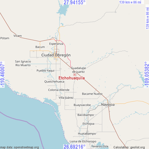
Etchohuaquila GPS coordinates[2]
27° 19' 6.996" North, 109° 45' 24.984" West
| Map corner | latitude | longitude |
|---|---|---|
| Upper-left | 27.94155°, | -110.46007° |
| Center: | 27.31861°, | -109.75694° |
| Lower-right: | 26.69216°, | -109.05382° |
| Map W x H: | 138.9×138.9 km | = 86.3×86.3mi |
| max Lat: | 32.7° ⇑3.3% North |
| Etchohuaquila: | 27.31861° |
| min Lat: | ⇓96.7% South 14.53588° |
| min Long | Etchohuaquila | max Long |
| -117.105° | -109.75694° | -86.73105° |
| W 2.1%⇐ | ⇒97.9% E |
Elevation
Elevation of Etchohuaquila is 71 m = 233 ft, and this is 1182.7 m = 3880 ft below average elevation for this country.
| Max E: |
3497 m = 11473 ft | 81.9% |
| Avg. | 1253.7 m = 4113 ft | |
| Etchohuaquila | 71 m = 233 ft | |
Min E: |
-1 m = -3 ft | 18.1% |
See also: Mexico elevation on elevation.city.
Geographical zone
Etchohuaquila is located in North temperate zone (between Tropic of Cancer and the Arctic Circle). Distance of this Northern Tropic circle is 431.6 km =268.2 mi to South.| Distance of | km | miles | from Etchohuaquila |
|---|---|---|---|
| North Pole | 6969.5 | 4330.6 | to North |
| Arctic Circle | 4363.6 | 2711.4 | to North |
| Tropic Cancer | 431.6 | 268.2 | to South |
| Equator | 3037.5 | 1887.4 | to South |


Nearby cities:
15 places around Etchohuaquila: (largest is in red/bold)
• Agua Blanca
22.9 km =14.2 mi,  174°
174°
• Allende
20.5 km =12.7 mi,  226°
226°
• Altos de Jecopaco
21.3 km =13.2 mi,  219°
219°
• Antonio Rosales
10.2 km =6.3 mi,  290°
290°
• Bacame Nuevo
24 km =14.9 mi,  137°
137°
• El Tobarito
14.7 km =9.1 mi, 293°
• Francisco Villa
7.7 km =4.8 mi,  317°
317°
• Fundición
2.5 km =1.6 mi,  55°
55°
• Jecopaco
13.4 km =8.3 mi,  185°
185°
• Marte R. Gómez (Tobarito)
13.9 km =8.6 mi, 293°
• Morelos Uno
24.1 km =15 mi,  259°
259°
• Pueblo Mayo
23.7 km =14.7 mi,  122°
122°
• Quetchehueca
20 km =12.4 mi,  252°
252°
• Santa María del Buáraje
4.9 km =3 mi, 246°
• Villa Juárez
22.6 km =14 mi,  201°
201°
Sources, notices
• [Note1] Compared only with cities in Mexico existing in our database
• [Src1] Map data: © OpenStreetMap contributors (CC-BY-SA)
• [Src2] Other city data from geonames.org with taken over terms of usage.
• [Src3] Geographical zone / Annual Mean Temperature by Robert A. Rohde @ Wikipedia
