Chinotahueca geodata
Chinotahueca (Sonora) is a populated place; located in Mexico in America/Hermosillo (GMT-7) time zone. With population of 969 people, there are 8976 cities with bigger population in this country. Compared to other cities in Mexico, 96.3% of cities are located further ↓South; 97.5% of cities are located further →East and 88.6% of cities have higher elevation than Chinotahueca. Note1


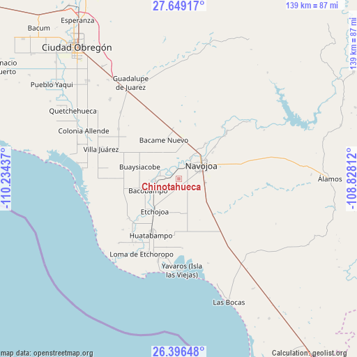
Chinotahueca GPS coordinates[2]
27° 1' 28.452" North, 109° 31' 52.464" West
| Map corner | latitude | longitude |
|---|---|---|
| Upper-left | 27.64917°, | -110.23437° |
| Center: | 27.02457°, | -109.53124° |
| Lower-right: | 26.39648°, | -108.82812° |
| Map W x H: | 139.3×139.3 km | = 86.6×86.6mi |
| max Lat: | 32.7° ⇑3.7% North |
| Chinotahueca: | 27.02457° |
| min Lat: | ⇓96.3% South 14.53588° |
| min Long | Chinotahueca | max Long |
| -117.105° | -109.53124° | -86.73105° |
| W 2.5%⇐ | ⇒97.5% E |
Elevation
Elevation of Chinotahueca is 28 m = 92 ft, and this is 1225.7 m = 4021 ft below average elevation for this country.
| Max E: |
3497 m = 11473 ft | 88.6% |
| Avg. | 1253.7 m = 4113 ft | |
| Chinotahueca | 28 m = 92 ft | |
Min E: |
-1 m = -3 ft | 11.4% |
See also: Mexico elevation on elevation.city.
Geographical zone
Chinotahueca is located in North temperate zone (between Tropic of Cancer and the Arctic Circle). Distance of this Northern Tropic circle is 398.9 km =247.9 mi to South.| Distance of | km | miles | from Chinotahueca |
|---|---|---|---|
| North Pole | 7002.2 | 4351 | to North |
| Arctic Circle | 4396.3 | 2731.7 | to North |
| Tropic Cancer | 398.9 | 247.9 | to South |
| Equator | 3004.9 | 1867.2 | to South |


Nearby cities:
15 places around Chinotahueca: (largest is in red/bold)
• Aquichopo
6.5 km =4 mi,  333°
333°
• Chucarit
5.3 km =3.3 mi,  278°
278°
• El Recodo
5.9 km =3.7 mi,  3°
3°
• El Rodeo
11.1 km =6.9 mi,  264°
264°
• El Siviral (Jigica)
9.1 km =5.7 mi,  19°
19°
• Jitonhueca
8.4 km =5.2 mi,  299°
299°
• Las Playitas
9.3 km =5.8 mi,  241°
241°
• Loma del Refugio
13 km =8.1 mi,  33°
33°
• Los Bahuises
12 km =7.5 mi, 31°
• Navojoa
10 km =6.2 mi,  59°
59°
• Navolato
3.9 km =2.4 mi,  285°
285°
• Rancho Camargo
8.4 km =5.2 mi, 0°
• San Pedro Río Mayo
10 km =6.2 mi,  267°
267°
• San Pedro Viejo
9.1 km =5.7 mi, 265°
• Siviral
9 km =5.6 mi, 18°
Sources, notices
• [Note1] Compared only with cities in Mexico existing in our database
• [Src1] Map data: © OpenStreetMap contributors (CC-BY-SA)
• [Src2] Other city data from geonames.org with taken over terms of usage.
• [Src3] Geographical zone / Annual Mean Temperature by Robert A. Rohde @ Wikipedia
