Navojoa geodata
Navojoa (Sonora) is a seat of a second-order administrative division; located in Mexico in America/Hermosillo (GMT-7) time zone. With population of 113,836 people, there are 125 cities with bigger population in this country. Compared to other cities in Mexico, 96.4% of cities are located further ↓South; 97.5% of cities are located further →East and 84.6% of cities have higher elevation than Navojoa. Note1


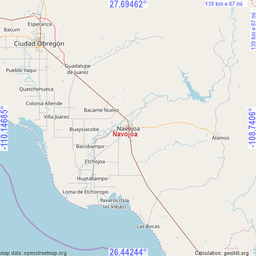
Navojoa GPS coordinates[2]
27° 4' 13.008" North, 109° 26' 37.392" West
| Map corner | latitude | longitude |
|---|---|---|
| Upper-left | 27.69462°, | -110.14685° |
| Center: | 27.07028°, | -109.44372° |
| Lower-right: | 26.44244°, | -108.7406° |
| Map W x H: | 139.2×139.2 km | = 86.5×86.5mi |
| max Lat: | 32.7° ⇑3.6% North |
| Navojoa: | 27.07028° |
| min Lat: | ⇓96.4% South 14.53588° |
| min Long | Navojoa | max Long |
| -117.105° | -109.44372° | -86.73105° |
| W 2.5%⇐ | ⇒97.5% E |
Elevation
Elevation of Navojoa is 47 m = 154 ft, and this is 1206.7 m = 3959 ft below average elevation for this country.
| Max E: |
3497 m = 11473 ft | 84.6% |
| Avg. | 1253.7 m = 4113 ft | |
| Navojoa | 47 m = 154 ft | |
Min E: |
-1 m = -3 ft | 15.4% |
See also: Navojoa elevation on elevation.city.
Geographical zone
Navojoa is located in North temperate zone (between Tropic of Cancer and the Arctic Circle). Distance of this Northern Tropic circle is 404 km =251 mi to South.| Distance of | km | miles | from Navojoa |
|---|---|---|---|
| North Pole | 6997.1 | 4347.8 | to North |
| Arctic Circle | 4391.2 | 2728.6 | to North |
| Tropic Cancer | 404 | 251 | to South |
| Equator | 3009.9 | 1870.3 | to South |


Nearby cities:
15 places around Navojoa: (largest is in red/bold)
• Aquichopo
11.6 km =7.2 mi,  273°
273°
• Buiyacusi
8.8 km =5.5 mi,  10°
10°
• Capohuiza
6.9 km =4.3 mi,  355°
355°
• Chibucú
6.8 km =4.2 mi,  40°
40°
• Chinotahueca
10 km =6.2 mi,  239°
239°
• Chucarit
14.6 km =9.1 mi,  252°
252°
• El Recodo
8.3 km =5.2 mi,  275°
275°
• El Siviral (Jigica)
6.7 km =4.2 mi,  302°
302°
• Guaymitas
4.5 km =2.8 mi, 6°
• Loma del Refugio
5.9 km =3.7 mi,  345°
345°
• Los Bahuises
5.7 km =3.5 mi,  335°
335°
• Navolato
13 km =8.1 mi, 251°
• Rancho Camargo
9.2 km =5.7 mi,  291°
291°
• Rosales
7 km =4.3 mi,  4°
4°
• Siviral
6.8 km =4.2 mi, 300°
Sources, notices
• [Note1] Compared only with cities in Mexico existing in our database
• [Src1] Map data: © OpenStreetMap contributors (CC-BY-SA)
• [Src2] Other city data from geonames.org with taken over terms of usage.
• [Src3] Geographical zone / Annual Mean Temperature by Robert A. Rohde @ Wikipedia
