Capula geodata
Capula (Michoacán) is a populated place; located in Mexico in America/Mexico_City (GMT-6) time zone. With population of 4,678 people, there are 1971 cities with bigger population in this country. Compared to other cities in Mexico, 50.4% of cities are located further ↓South; 79.7% of cities are located further →East and 97.7% of cities have lower elevation than Capula. Note1


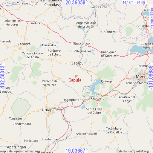
Capula GPS coordinates[2]
19° 42' 0" North, 101° 48' 0" West
| Map corner | latitude | longitude |
|---|---|---|
| Upper-left | 20.36059°, | -102.50313° |
| Center: | 19.7°, | -101.8° |
| Lower-right: | 19.03667°, | -101.09688° |
| Map W x H: | 147.2×147.2 km | = 91.5×91.5mi |
| max Lat: | 32.7° ⇑49.6% North |
| Capula: | 19.7° |
| min Lat: | ⇓50.4% South 14.53588° |
| min Long | Capula | max Long |
| -117.105° | -101.8° | -86.73105° |
| W 20.3%⇐ | ⇒79.7% E |
Elevation
Elevation of Capula is 2725 m = 8940 ft, and this is 1471.3 m = 4827 ft above average elevation for this country.
| Max E: |
3497 m = 11473 ft | 2.3% |
| Capula | 2725 m 8940 ft | |
| Avg. | 1253.7 m = 4113 ft | |
Min E: |
-1 m = -3 ft | 97.7% |
See also: Mexico elevation on elevation.city.
Geographical zone
Capula is located in North Torrid zone (between Equator and Tropic of Cancer). Distance of this Northern Tropic circle is 415.5 km =258.2 mi to North.| Distance of | km | miles | from Capula |
|---|---|---|---|
| North Pole | 7816.6 | 4857 | to North |
| Arctic Circle | 5210.7 | 3237.8 | to North |
| Tropic Cancer | 415.5 | 258.2 | to North |
| Equator | 2190.4 | 1361.1 | to South |


Nearby cities:
15 places around Capula: (largest is in red/bold)
• Comanjá
12.6 km =7.8 mi,  65°
65°
• Cortijo Nuevo
13.9 km =8.6 mi,  48°
48°
• David Franco Reyes
10 km =6.2 mi, 51°
• La Mojonera
3.5 km =2.2 mi,  276°
276°
• Lázaro Cárdenas (Colonia de Lázaro Cárdenas)
6 km =3.7 mi,  109°
109°
• Morelos
9.9 km =6.2 mi,  21°
21°
• Nahuatzén
13.2 km =8.2 mi,  247°
247°
• Naranja de Tapia
9.6 km =6 mi,  26°
26°
• Pichátaro
14.2 km =8.8 mi,  183°
183°
• San Isidro
7.1 km =4.4 mi,  205°
205°
• Santiago Azajo
11.9 km =7.4 mi,  86°
86°
• Sevina
13.2 km =8.2 mi,  233°
233°
• Tiríndaro
9.9 km =6.2 mi,  36°
36°
• Zacapu
13.6 km =8.5 mi,  4°
4°
• Zacapú
12.7 km =7.9 mi, 3°
Sources, notices
• [Note1] Compared only with cities in Mexico existing in our database
• [Src1] Map data: © OpenStreetMap contributors (CC-BY-SA)
• [Src2] Other city data from geonames.org with taken over terms of usage.
• [Src3] Geographical zone / Annual Mean Temperature by Robert A. Rohde @ Wikipedia
