Bacobampo geodata
Bacobampo (Sonora) is a populated place; located in Mexico in America/Hermosillo (GMT-7) time zone. With population of 8,539 people, there are 1117 cities with bigger population in this country. Compared to other cities in Mexico, 96.3% of cities are located further ↓South; 97.7% of cities are located further →East and 90.8% of cities have higher elevation than Bacobampo. Note1


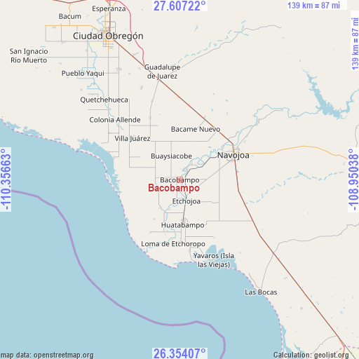
Bacobampo GPS coordinates[2]
26° 58' 56.604" North, 109° 39' 12.6" West
| Map corner | latitude | longitude |
|---|---|---|
| Upper-left | 27.60722°, | -110.35663° |
| Center: | 26.98239°, | -109.6535° |
| Lower-right: | 26.35407°, | -108.95038° |
| Map W x H: | 139.3×139.3 km | = 86.6×86.6mi |
| max Lat: | 32.7° ⇑3.7% North |
| Bacobampo: | 26.98239° |
| min Lat: | ⇓96.3% South 14.53588° |
| min Long | Bacobampo | max Long |
| -117.105° | -109.6535° | -86.73105° |
| W 2.3%⇐ | ⇒97.7% E |
Elevation
Elevation of Bacobampo is 22 m = 72 ft, and this is 1231.7 m = 4041 ft below average elevation for this country.
| Max E: |
3497 m = 11473 ft | 90.8% |
| Avg. | 1253.7 m = 4113 ft | |
| Bacobampo | 22 m = 72 ft | |
Min E: |
-1 m = -3 ft | 9.2% |
See also: Mexico elevation on elevation.city.
Geographical zone
Bacobampo is located in North temperate zone (between Tropic of Cancer and the Arctic Circle). Distance of this Northern Tropic circle is 394.2 km =244.9 mi to South.| Distance of | km | miles | from Bacobampo |
|---|---|---|---|
| North Pole | 7006.9 | 4353.9 | to North |
| Arctic Circle | 4401 | 2734.7 | to North |
| Tropic Cancer | 394.2 | 244.9 | to South |
| Equator | 3000.2 | 1864.2 | to South |


Nearby cities:
15 places around Bacobampo: (largest is in red/bold)
• Basconcobe
3.4 km =2.1 mi,  206°
206°
• Chucarit
8.8 km =5.5 mi,  51°
51°
• El Rodeo
3.8 km =2.4 mi,  16°
16°
• El Sahuaral
6.4 km =4 mi,  191°
191°
• Etchojoa
8.4 km =5.2 mi,  161°
161°
• Guayparín
1.9 km =1.2 mi, 159°
• Jitonhueca
10 km =6.2 mi,  28°
28°
• Las Guayabas
10.1 km =6.3 mi,  200°
200°
• Las Playitas
4 km =2.5 mi,  85°
85°
• Mochidaco
5.1 km =3.2 mi, 186°
• Mocorua
8.2 km =5.1 mi,  250°
250°
• Navolato
10.1 km =6.3 mi,  55°
55°
• San Pedro Río Mayo
4.8 km =3 mi, 26°
• San Pedro Viejo
5 km =3.1 mi,  37°
37°
• Villa Tres Cruces
8.7 km =5.4 mi, 189°
Sources, notices
• [Note1] Compared only with cities in Mexico existing in our database
• [Src1] Map data: © OpenStreetMap contributors (CC-BY-SA)
• [Src2] Other city data from geonames.org with taken over terms of usage.
• [Src3] Geographical zone / Annual Mean Temperature by Robert A. Rohde @ Wikipedia
