San Pedro Viejo geodata
San Pedro Viejo (Sonora) is a populated place; located in Mexico in America/Hermosillo (GMT-7) time zone. With population of 933 people, there are 9344 cities with bigger population in this country. Compared to other cities in Mexico, 96.3% of cities are located further ↓South; 97.6% of cities are located further →East and 91.2% of cities have higher elevation than San Pedro Viejo. Note1


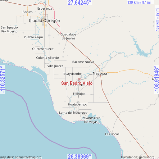
San Pedro Viejo GPS coordinates[2]
27° 1' 4.152" North, 109° 37' 21.288" West
| Map corner | latitude | longitude |
|---|---|---|
| Upper-left | 27.64245°, | -110.32571° |
| Center: | 27.01782°, | -109.62258° |
| Lower-right: | 26.38969°, | -108.91946° |
| Map W x H: | 139.3×139.3 km | = 86.6×86.6mi |
| max Lat: | 32.7° ⇑3.7% North |
| San Pedro Viejo: | 27.01782° |
| min Lat: | ⇓96.3% South 14.53588° |
| min Long | San Pedro Viejo | max Long |
| -117.105° | -109.62258° | -86.73105° |
| W 2.4%⇐ | ⇒97.6% E |
Elevation
Elevation of San Pedro Viejo is 21 m = 69 ft, and this is 1232.7 m = 4044 ft below average elevation for this country.
| Max E: |
3497 m = 11473 ft | 91.2% |
| Avg. | 1253.7 m = 4113 ft | |
| San Pedro Viejo | 21 m = 69 ft | |
Min E: |
-1 m = -3 ft | 8.8% |
See also: Mexico elevation on elevation.city.
Geographical zone
San Pedro Viejo is located in North temperate zone (between Tropic of Cancer and the Arctic Circle). Distance of this Northern Tropic circle is 398.2 km =247.4 mi to South.| Distance of | km | miles | from San Pedro Viejo |
|---|---|---|---|
| North Pole | 7003 | 4351.5 | to North |
| Arctic Circle | 4397.1 | 2732.2 | to North |
| Tropic Cancer | 398.2 | 247.4 | to South |
| Equator | 3004.1 | 1866.7 | to South |


Nearby cities:
15 places around San Pedro Viejo: (largest is in red/bold)
• Aquichopo
9 km =5.6 mi,  43°
43°
• Bacobampo
5 km =3.1 mi,  217°
217°
• Basconcobe
8.3 km =5.2 mi,  213°
213°
• Buaysiacobe
8.4 km =5.2 mi,  311°
311°
• Chinotahueca
9.1 km =5.7 mi,  85°
85°
• Chucarit
4.1 km =2.5 mi,  68°
68°
• El Recodo
11.5 km =7.1 mi,  54°
54°
• El Rodeo
2 km =1.2 mi,  260°
260°
• El Sahuaral
11.1 km =6.9 mi,  203°
203°
• Guayparín
6.2 km =3.9 mi, 202°
• Jitonhueca
5.2 km =3.2 mi,  19°
19°
• Las Playitas
3.8 km =2.4 mi,  166°
166°
• Mochidaco
9.7 km =6 mi, 202°
• Navolato
5.6 km =3.5 mi, 71°
• San Pedro Río Mayo
1 km =0.6 mi,  290°
290°
Sources, notices
• [Note1] Compared only with cities in Mexico existing in our database
• [Src1] Map data: © OpenStreetMap contributors (CC-BY-SA)
• [Src2] Other city data from geonames.org with taken over terms of usage.
• [Src3] Geographical zone / Annual Mean Temperature by Robert A. Rohde @ Wikipedia
