Apúndaro geodata
Apúndaro (Michoacán) is a populated place; located in Mexico in America/Mexico_City (GMT-6) time zone. With population of 668 people, there are 12987 cities with bigger population in this country. Compared to other cities in Mexico, 57.6% of cities are located further ↑North; 83.7% of cities are located further →East and 57.8% of cities have lower elevation than Apúndaro. Note1


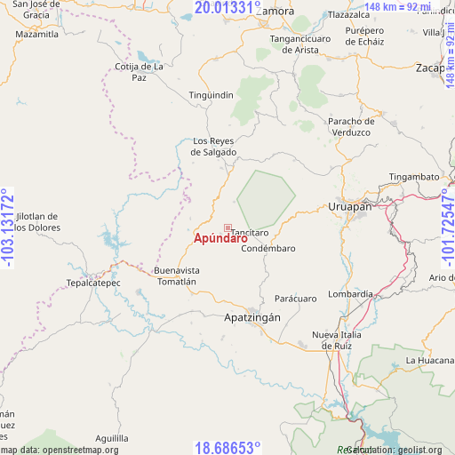
Apúndaro GPS coordinates[2]
19° 21' 4.572" North, 102° 25' 42.924" West
| Map corner | latitude | longitude |
|---|---|---|
| Upper-left | 20.01331°, | -103.13172° |
| Center: | 19.35127°, | -102.42859° |
| Lower-right: | 18.68653°, | -101.72547° |
| Map W x H: | 147.5×147.5 km | = 91.7×91.7mi |
| max Lat: | 32.7° ⇑57.6% North |
| Apúndaro: | 19.35127° |
| min Lat: | ⇓42.4% South 14.53588° |
| min Long | Apúndaro | max Long |
| -117.105° | -102.42859° | -86.73105° |
| W 16.3%⇐ | ⇒83.7% E |
Elevation
Elevation of Apúndaro is 1687 m = 5535 ft, and this is 433.3 m = 1422 ft above average elevation for this country.
| Max E: |
3497 m = 11473 ft | 42.2% |
| Apúndaro | 1687 m 5535 ft | |
| Avg. | 1253.7 m = 4113 ft | |
Min E: |
-1 m = -3 ft | 57.8% |
See also: Mexico elevation on elevation.city.
Geographical zone
Apúndaro is located in North Torrid zone (between Equator and Tropic of Cancer). Distance of this Northern Tropic circle is 454.3 km =282.3 mi to North.| Distance of | km | miles | from Apúndaro |
|---|---|---|---|
| North Pole | 7855.4 | 4881.1 | to North |
| Arctic Circle | 5249.5 | 3261.9 | to North |
| Tropic Cancer | 454.3 | 282.3 | to North |
| Equator | 2151.7 | 1337 | to South |


Nearby cities:
15 places around Apúndaro: (largest is in red/bold)
• Agua Zarca
14.1 km =8.8 mi,  150°
150°
• Apo
8.6 km =5.3 mi,  12°
12°
• Araparícuaro (Aparícuaro)
15.4 km =9.6 mi,  99°
99°
• Carona
19.6 km =12.2 mi,  353°
353°
• Choritiro
4.3 km =2.7 mi,  60°
60°
• Condémbaro
14.6 km =9.1 mi,  116°
116°
• Gildardo Magaña (Los Ángeles)
22.2 km =13.8 mi, 351°
• Los Fresnos
3.8 km =2.4 mi,  166°
166°
• Peribán de Ramos
18.8 km =11.7 mi,  4°
4°
• Plan de Ayala
22.1 km =13.7 mi,  343°
343°
• Páreo
3.2 km =2 mi,  230°
230°
• Santa Catarina
7.5 km =4.7 mi, 154°
• Tancítaro
7.1 km =4.4 mi, 101°
• Zirimbó
12.8 km =8 mi, 115°
• Zirímondiro
8.8 km =5.5 mi,  88°
88°
Sources, notices
• [Note1] Compared only with cities in Mexico existing in our database
• [Src1] Map data: © OpenStreetMap contributors (CC-BY-SA)
• [Src2] Other city data from geonames.org with taken over terms of usage.
• [Src3] Geographical zone / Annual Mean Temperature by Robert A. Rohde @ Wikipedia
