Los Fresnos geodata
Los Fresnos (Michoacán) is a populated place; located in Mexico in America/Mexico_City (GMT-6) time zone. With population of 720 people, there are 12117 cities with bigger population in this country. Compared to other cities in Mexico, 58.4% of cities are located further ↑North; 83.6% of cities are located further →East and 71.8% of cities have lower elevation than Los Fresnos. Note1


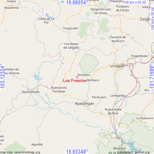
Los Fresnos GPS coordinates[2]
19° 19' 6.096" North, 102° 25' 12.396" West
| Map corner | latitude | longitude |
|---|---|---|
| Upper-left | 19.98054°, | -103.12324° |
| Center: | 19.31836°, | -102.42011° |
| Lower-right: | 18.65349°, | -101.71699° |
| Map W x H: | 147.6×147.6 km | = 91.7×91.7mi |
| max Lat: | 32.7° ⇑58.4% North |
| Los Fresnos: | 19.31836° |
| min Lat: | ⇓41.6% South 14.53588° |
| min Long | Los Fresnos | max Long |
| -117.105° | -102.42011° | -86.73105° |
| W 16.4%⇐ | ⇒83.6% E |
Elevation
Elevation of Los Fresnos is 1963 m = 6440 ft, and this is 709.3 m = 2327 ft above average elevation for this country.
| Max E: |
3497 m = 11473 ft | 28.2% |
| Los Fresnos | 1963 m 6440 ft | |
| Avg. | 1253.7 m = 4113 ft | |
Min E: |
-1 m = -3 ft | 71.8% |
See also: Mexico elevation on elevation.city.
Geographical zone
Los Fresnos is located in North Torrid zone (between Equator and Tropic of Cancer). Distance of this Northern Tropic circle is 457.9 km =284.5 mi to North.| Distance of | km | miles | from Los Fresnos |
|---|---|---|---|
| North Pole | 7859.1 | 4883.4 | to North |
| Arctic Circle | 5253.2 | 3264.2 | to North |
| Tropic Cancer | 457.9 | 284.5 | to North |
| Equator | 2148 | 1334.7 | to South |


Nearby cities:
15 places around Los Fresnos: (largest is in red/bold)
• Agua Zarca
10.6 km =6.6 mi,  144°
144°
• Apo
12.1 km =7.5 mi,  4°
4°
• Apúndaro
3.8 km =2.4 mi,  346°
346°
• Araparícuaro (Aparícuaro)
14.3 km =8.9 mi,  85°
85°
• Buenavista Tomatlán
21.1 km =13.1 mi,  236°
236°
• Choritiro
6.4 km =4 mi,  26°
26°
• Condémbaro
12.5 km =7.8 mi,  103°
103°
• Páreo
3.7 km =2.3 mi,  295°
295°
• San Juan De Los Platanos
20.3 km =12.6 mi,  185°
185°
• San Juan de los Plátanos
20.4 km =12.7 mi, 185°
• Santa Ana Amatlán
21.6 km =13.4 mi,  215°
215°
• Santa Catarina
3.9 km =2.4 mi, 143°
• Tancítaro
6.4 km =4 mi,  69°
69°
• Zirimbó
10.8 km =6.7 mi, 99°
• Zirímondiro
8.8 km =5.5 mi,  64°
64°
Sources, notices
• [Note1] Compared only with cities in Mexico existing in our database
• [Src1] Map data: © OpenStreetMap contributors (CC-BY-SA)
• [Src2] Other city data from geonames.org with taken over terms of usage.
• [Src3] Geographical zone / Annual Mean Temperature by Robert A. Rohde @ Wikipedia
