Alfajayucan geodata
Alfajayucan (Querétaro) is a populated place; located in Mexico in America/Mexico_City (GMT-6) time zone. With population of 2,617 people, there are 3388 cities with bigger population in this country. Compared to other cities in Mexico, 72.6% of cities are located further ↓South; 66.6% of cities are located further →East and 72.9% of cities have lower elevation than Alfajayucan. Note1


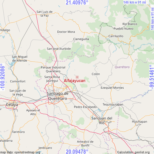
Alfajayucan GPS coordinates[2]
20° 45' 13.32" North, 100° 13' 3.828" West
| Map corner | latitude | longitude |
|---|---|---|
| Upper-left | 21.40976°, | -100.92086° |
| Center: | 20.7537°, | -100.21773° |
| Lower-right: | 20.09478°, | -99.51461° |
| Map W x H: | 146.2×146.2 km | = 90.8×90.8mi |
| max Lat: | 32.7° ⇑27.4% North |
| Alfajayucan: | 20.7537° |
| min Lat: | ⇓72.6% South 14.53588° |
| min Long | Alfajayucan | max Long |
| -117.105° | -100.21773° | -86.73105° |
| W 33.4%⇐ | ⇒66.6% E |
Elevation
Elevation of Alfajayucan is 1988 m = 6522 ft, and this is 734.3 m = 2409 ft above average elevation for this country.
| Max E: |
3497 m = 11473 ft | 27.1% |
| Alfajayucan | 1988 m 6522 ft | |
| Avg. | 1253.7 m = 4113 ft | |
Min E: |
-1 m = -3 ft | 72.9% |
See also: Mexico elevation on elevation.city.
Geographical zone
Alfajayucan is located in North Torrid zone (between Equator and Tropic of Cancer). Distance of this Northern Tropic circle is 298.3 km =185.4 mi to North.| Distance of | km | miles | from Alfajayucan |
|---|---|---|---|
| North Pole | 7699.5 | 4784.2 | to North |
| Arctic Circle | 5093.6 | 3165 | to North |
| Tropic Cancer | 298.3 | 185.4 | to North |
| Equator | 2307.6 | 1433.9 | to South |


Nearby cities:
15 places around Alfajayucan: (largest is in red/bold)
• Amazcala
7.5 km =4.7 mi,  221°
221°
• Atongo
3.1 km =1.9 mi,  313°
313°
• Carbonera
7.5 km =4.7 mi,  40°
40°
• El Lobo
3.2 km =2 mi,  149°
149°
• El Saucillo
6.1 km =3.8 mi,  21°
21°
• La Griega
10 km =6.2 mi,  193°
193°
• Nogales
9.7 km =6 mi,  129°
129°
• Presa de Rayas
6 km =3.7 mi,  355°
355°
• Puerta de Enmedio
7.8 km =4.8 mi,  81°
81°
• San Miguel Amazcala
1.9 km =1.2 mi,  259°
259°
• San Rafael
7.1 km =4.4 mi,  268°
268°
• Santa Cruz
10.1 km =6.3 mi,  242°
242°
• Santa María Begoña
10.4 km =6.5 mi, 265°
• Santa María Ticomán
10.5 km =6.5 mi,  206°
206°
• Vista Hermosa
4.7 km =2.9 mi,  88°
88°
Sources, notices
• [Note1] Compared only with cities in Mexico existing in our database
• [Src1] Map data: © OpenStreetMap contributors (CC-BY-SA)
• [Src2] Other city data from geonames.org with taken over terms of usage.
• [Src3] Geographical zone / Annual Mean Temperature by Robert A. Rohde @ Wikipedia
