El Lobo geodata
El Lobo (Querétaro) is a populated place; located in Mexico in America/Mexico_City (GMT-6) time zone. With population of 1,781 people, there are 4880 cities with bigger population in this country. Compared to other cities in Mexico, 72.2% of cities are located further ↓South; 66.5% of cities are located further →East and 74.3% of cities have lower elevation than El Lobo. Note1


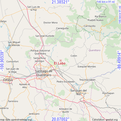
El Lobo GPS coordinates[2]
20° 43' 44.544" North, 100° 12' 8.136" West
| Map corner | latitude | longitude |
|---|---|---|
| Upper-left | 21.38521°, | -100.90539° |
| Center: | 20.72904°, | -100.20226° |
| Lower-right: | 20.07002°, | -99.49914° |
| Map W x H: | 146.2×146.2 km | = 90.8×90.8mi |
| max Lat: | 32.7° ⇑27.8% North |
| El Lobo: | 20.72904° |
| min Lat: | ⇓72.2% South 14.53588° |
| min Long | El Lobo | max Long |
| -117.105° | -100.20226° | -86.73105° |
| W 33.5%⇐ | ⇒66.5% E |
Elevation
Elevation of El Lobo is 2018 m = 6621 ft, and this is 764.3 m = 2508 ft above average elevation for this country.
| Max E: |
3497 m = 11473 ft | 25.7% |
| El Lobo | 2018 m 6621 ft | |
| Avg. | 1253.7 m = 4113 ft | |
Min E: |
-1 m = -3 ft | 74.3% |
See also: Mexico elevation on elevation.city.
Geographical zone
El Lobo is located in North Torrid zone (between Equator and Tropic of Cancer). Distance of this Northern Tropic circle is 301.1 km =187.1 mi to North.| Distance of | km | miles | from El Lobo |
|---|---|---|---|
| North Pole | 7702.2 | 4785.9 | to North |
| Arctic Circle | 5096.3 | 3166.7 | to North |
| Tropic Cancer | 301.1 | 187.1 | to North |
| Equator | 2304.9 | 1432.2 | to South |


Nearby cities:
15 places around El Lobo: (largest is in red/bold)
• Alfajayucan
3.2 km =2 mi,  329°
329°
• Amazcala
7.1 km =4.4 mi,  246°
246°
• Atongo
6.2 km =3.9 mi,  321°
321°
• Carbonera
9.1 km =5.7 mi,  20°
20°
• El Saucillo
8.4 km =5.2 mi,  3°
3°
• Guadalupe la Venta
9.5 km =5.9 mi,  192°
192°
• La Griega
8 km =5 mi,  209°
209°
• Nogales
6.8 km =4.2 mi,  119°
119°
• Presa de Rayas
8.9 km =5.5 mi,  346°
346°
• Puerta de Enmedio
7.2 km =4.5 mi,  57°
57°
• San Miguel Amazcala
4.2 km =2.6 mi,  304°
304°
• San Rafael
9.1 km =5.7 mi,  286°
286°
• Santa Fe Libertadores
9.4 km =5.8 mi,  220°
220°
• Santa María Ticomán
9.1 km =5.7 mi, 223°
• Vista Hermosa
4.3 km =2.7 mi,  47°
47°
Sources, notices
• [Note1] Compared only with cities in Mexico existing in our database
• [Src1] Map data: © OpenStreetMap contributors (CC-BY-SA)
• [Src2] Other city data from geonames.org with taken over terms of usage.
• [Src3] Geographical zone / Annual Mean Temperature by Robert A. Rohde @ Wikipedia
