Los Lorenzos geodata
Los Lorenzos (Guanajuato) is a populated place; located in Mexico in America/Mexico_City (GMT-6) time zone. With population of 1,380 people, there are 6280 cities with bigger population in this country. Compared to other cities in Mexico, 77.5% of cities are located further ↓South; 76.2% of cities are located further →East and 72.4% of cities have lower elevation than Los Lorenzos. Note1


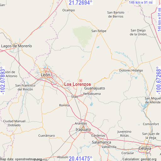
Los Lorenzos GPS coordinates[2]
21° 4' 20.244" North, 101° 22' 32.88" West
| Map corner | latitude | longitude |
|---|---|---|
| Upper-left | 21.72694°, | -102.07893° |
| Center: | 21.07229°, | -101.3758° |
| Lower-right: | 20.41475°, | -100.67268° |
| Map W x H: | 145.9×145.9 km | = 90.7×90.7mi |
| max Lat: | 32.7° ⇑22.5% North |
| Los Lorenzos: | 21.07229° |
| min Lat: | ⇓77.5% South 14.53588° |
| min Long | Los Lorenzos | max Long |
| -117.105° | -101.3758° | -86.73105° |
| W 23.8%⇐ | ⇒76.2% E |
Elevation
Elevation of Los Lorenzos is 1975 m = 6480 ft, and this is 721.3 m = 2366 ft above average elevation for this country.
| Max E: |
3497 m = 11473 ft | 27.6% |
| Los Lorenzos | 1975 m 6480 ft | |
| Avg. | 1253.7 m = 4113 ft | |
Min E: |
-1 m = -3 ft | 72.4% |
See also: Mexico elevation on elevation.city.
Geographical zone
Los Lorenzos is located in North Torrid zone (between Equator and Tropic of Cancer). Distance of this Northern Tropic circle is 262.9 km =163.4 mi to North.| Distance of | km | miles | from Los Lorenzos |
|---|---|---|---|
| North Pole | 7664 | 4762.2 | to North |
| Arctic Circle | 5058.2 | 3143 | to North |
| Tropic Cancer | 262.9 | 163.4 | to North |
| Equator | 2343 | 1455.9 | to South |


Nearby cities:
15 places around Los Lorenzos: (largest is in red/bold)
• Arperos
4.2 km =2.6 mi,  327°
327°
• Chichimequillas
8 km =5 mi,  240°
240°
• Comanjilla
10.1 km =6.3 mi,  265°
265°
• El Paraíso
5.2 km =3.2 mi,  196°
196°
• Loma de Yerbabuena
7.8 km =4.8 mi,  260°
260°
• Mineral de la Luz
4 km =2.5 mi,  102°
102°
• Pabileros
9.6 km =6 mi,  193°
193°
• Paxtle
3.3 km =2.1 mi, 243°
• Providencia de Nápoles
10.1 km =6.3 mi, 237°
• Rancho Seco
10 km =6.2 mi, 204°
• Salitrillo
9.3 km =5.8 mi, 244°
• San Agustín de las Flores
9.6 km =6 mi,  221°
221°
• Tuna Mansa
5.8 km =3.6 mi,  211°
211°
• Vaquerías
9.5 km =5.9 mi,  347°
347°
• Velarde
8.5 km =5.3 mi, 195°
Sources, notices
• [Note1] Compared only with cities in Mexico existing in our database
• [Src1] Map data: © OpenStreetMap contributors (CC-BY-SA)
• [Src2] Other city data from geonames.org with taken over terms of usage.
• [Src3] Geographical zone / Annual Mean Temperature by Robert A. Rohde @ Wikipedia
