Mineral de la Luz geodata
Mineral de la Luz (Guanajuato) is a populated place; located in Mexico in America/Mexico_City (GMT-6) time zone. With population of 1,040 people, there are 8386 cities with bigger population in this country. Compared to other cities in Mexico, 77.4% of cities are located further ↓South; 75.9% of cities are located further →East and 89.9% of cities have lower elevation than Mineral de la Luz. Note1


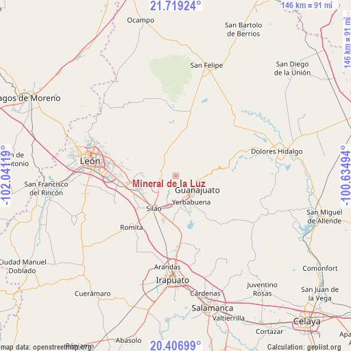
Mineral de la Luz GPS coordinates[2]
21° 3' 52.416" North, 101° 20' 17.016" West
| Map corner | latitude | longitude |
|---|---|---|
| Upper-left | 21.71924°, | -102.04119° |
| Center: | 21.06456°, | -101.33806° |
| Lower-right: | 20.40699°, | -100.63494° |
| Map W x H: | 145.9×145.9 km | = 90.7×90.7mi |
| max Lat: | 32.7° ⇑22.6% North |
| Mineral de la Luz: | 21.06456° |
| min Lat: | ⇓77.4% South 14.53588° |
| min Long | Mineral de la L | max Long |
| -117.105° | -101.33806° | -86.73105° |
| W 24.1%⇐ | ⇒75.9% E |
Elevation
Elevation of Mineral de la Luz is 2402 m = 7881 ft, and this is 1148.3 m = 3767 ft above average elevation for this country.
| Max E: |
3497 m = 11473 ft | 10.1% |
| Mineral de la Luz | 2402 m 7881 ft | |
| Avg. | 1253.7 m = 4113 ft | |
Min E: |
-1 m = -3 ft | 89.9% |
See also: Mexico elevation on elevation.city.
Geographical zone
Mineral de la Luz is located in North Torrid zone (between Equator and Tropic of Cancer). Distance of this Northern Tropic circle is 263.8 km =163.9 mi to North.| Distance of | km | miles | from Mineral de la Luz |
|---|---|---|---|
| North Pole | 7664.9 | 4762.7 | to North |
| Arctic Circle | 5059 | 3143.5 | to North |
| Tropic Cancer | 263.8 | 163.9 | to North |
| Equator | 2342.2 | 1455.4 | to South |


Nearby cities:
15 places around Mineral de la Luz: (largest is in red/bold)
• Aguas Buenas
11.1 km =6.9 mi,  198°
198°
• Arperos
7.5 km =4.7 mi,  305°
305°
• Chichimequillas
11.3 km =7 mi,  254°
254°
• El Paraíso
6.8 km =4.2 mi,  232°
232°
• Guanajuato
9.7 km =6 mi,  121°
121°
• La Concepción
9.6 km =6 mi,  70°
70°
• Los Lorenzos
4 km =2.5 mi,  282°
282°
• Marfil
9.8 km =6.1 mi,  145°
145°
• Pabileros
10.5 km =6.5 mi,  216°
216°
• Paxtle
6.9 km =4.3 mi,  264°
264°
• Rancho Seco
11.5 km =7.1 mi, 224°
• San José de Cervera
11.4 km =7.1 mi,  161°
161°
• Santa Ana (Santana)
7.1 km =4.4 mi,  104°
104°
• Tuna Mansa
8.1 km =5 mi,  239°
239°
• Velarde
9.6 km =6 mi, 220°
Sources, notices
• [Note1] Compared only with cities in Mexico existing in our database
• [Src1] Map data: © OpenStreetMap contributors (CC-BY-SA)
• [Src2] Other city data from geonames.org with taken over terms of usage.
• [Src3] Geographical zone / Annual Mean Temperature by Robert A. Rohde @ Wikipedia
