Corral de Santiago geodata
Corral de Santiago (Guanajuato) is a populated place; located in Mexico in America/Mexico_City (GMT-6) time zone. With population of 783 people, there are 11148 cities with bigger population in this country. Compared to other cities in Mexico, 64.2% of cities are located further ↓South; 80.2% of cities are located further →East and 57.7% of cities have lower elevation than Corral de Santiago. Note1


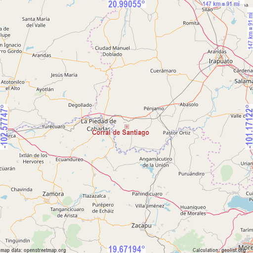
Corral de Santiago GPS coordinates[2]
20° 19' 57.54" North, 101° 52' 27.624" West
| Map corner | latitude | longitude |
|---|---|---|
| Upper-left | 20.99055°, | -102.57747° |
| Center: | 20.33265°, | -101.87434° |
| Lower-right: | 19.67194°, | -101.17122° |
| Map W x H: | 146.6×146.6 km | = 91.1×91.1mi |
| max Lat: | 32.7° ⇑35.8% North |
| Corral de Santiago: | 20.33265° |
| min Lat: | ⇓64.2% South 14.53588° |
| min Long | Corral de Santi | max Long |
| -117.105° | -101.87434° | -86.73105° |
| W 19.8%⇐ | ⇒80.2% E |
Elevation
Elevation of Corral de Santiago is 1683 m = 5522 ft, and this is 429.3 m = 1408 ft above average elevation for this country.
| Max E: |
3497 m = 11473 ft | 42.3% |
| Corral de Santiago | 1683 m 5522 ft | |
| Avg. | 1253.7 m = 4113 ft | |
Min E: |
-1 m = -3 ft | 57.7% |
See also: Mexico elevation on elevation.city.
Geographical zone
Corral de Santiago is located in North Torrid zone (between Equator and Tropic of Cancer). Distance of this Northern Tropic circle is 345.1 km =214.4 mi to North.| Distance of | km | miles | from Corral de Santiago |
|---|---|---|---|
| North Pole | 7746.3 | 4813.3 | to North |
| Arctic Circle | 5140.4 | 3194.1 | to North |
| Tropic Cancer | 345.1 | 214.4 | to North |
| Equator | 2260.8 | 1404.8 | to South |


Nearby cities:
15 places around Corral de Santiago: (largest is in red/bold)
• Aratzipu
7.8 km =4.8 mi,  2°
2°
• Buenavista de Cortés
4.5 km =2.8 mi,  5°
5°
• Castillo de Villaseñor
6.4 km =4 mi,  151°
151°
• Colonia Morelos
4.7 km =2.9 mi,  326°
326°
• Colorado de Herrera
3.5 km =2.2 mi,  115°
115°
• Cuevas de Morales
5.4 km =3.4 mi,  143°
143°
• El Infiernillo
7.8 km =4.8 mi, 154°
• La Cal Grande
7.3 km =4.5 mi,  279°
279°
• La Estancia del Refugio
7.2 km =4.5 mi,  235°
235°
• La Lobera
6.5 km =4 mi,  214°
214°
• Lagunillas
3.3 km =2.1 mi,  229°
229°
• Mezquite de Luna
4.3 km =2.7 mi, 206°
• Palo Verde
2.8 km =1.7 mi,  110°
110°
• San Bernardo
4.1 km =2.5 mi,  48°
48°
• San Rafael de la Maraña
7.3 km =4.5 mi,  336°
336°
Sources, notices
• [Note1] Compared only with cities in Mexico existing in our database
• [Src1] Map data: © OpenStreetMap contributors (CC-BY-SA)
• [Src2] Other city data from geonames.org with taken over terms of usage.
• [Src3] Geographical zone / Annual Mean Temperature by Robert A. Rohde @ Wikipedia
