Lagunillas geodata
Lagunillas (Guanajuato) is a populated place; located in Mexico in America/Mexico_City (GMT-6) time zone. With population of 830 people, there are 10537 cities with bigger population in this country. Compared to other cities in Mexico, 63.8% of cities are located further ↓South; 80.3% of cities are located further →East and 57.7% of cities have lower elevation than Lagunillas. Note1


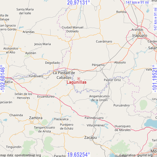
Lagunillas GPS coordinates[2]
20° 18' 47.988" North, 101° 53' 53.988" West
| Map corner | latitude | longitude |
|---|---|---|
| Upper-left | 20.97131°, | -102.60146° |
| Center: | 20.31333°, | -101.89833° |
| Lower-right: | 19.65254°, | -101.19521° |
| Map W x H: | 146.6×146.6 km | = 91.1×91.1mi |
| max Lat: | 32.7° ⇑36.2% North |
| Lagunillas: | 20.31333° |
| min Lat: | ⇓63.8% South 14.53588° |
| min Long | Lagunillas | max Long |
| -117.105° | -101.89833° | -86.73105° |
| W 19.7%⇐ | ⇒80.3% E |
Elevation
Elevation of Lagunillas is 1682 m = 5518 ft, and this is 428.3 m = 1405 ft above average elevation for this country.
| Max E: |
3497 m = 11473 ft | 42.3% |
| Lagunillas | 1682 m 5518 ft | |
| Avg. | 1253.7 m = 4113 ft | |
Min E: |
-1 m = -3 ft | 57.7% |
See also: Mexico elevation on elevation.city.
Geographical zone
Lagunillas is located in North Torrid zone (between Equator and Tropic of Cancer). Distance of this Northern Tropic circle is 347.3 km =215.8 mi to North.| Distance of | km | miles | from Lagunillas |
|---|---|---|---|
| North Pole | 7748.4 | 4814.6 | to North |
| Arctic Circle | 5142.5 | 3195.4 | to North |
| Tropic Cancer | 347.3 | 215.8 | to North |
| Equator | 2258.6 | 1403.4 | to South |


Nearby cities:
15 places around Lagunillas: (largest is in red/bold)
• Buenavista de Cortés
7.3 km =4.5 mi,  23°
23°
• Castillo de Villaseñor
6.6 km =4.1 mi,  122°
122°
• Cañada de Ramírez
7.1 km =4.4 mi,  254°
254°
• Colonia Morelos
6.1 km =3.8 mi,  358°
358°
• Colorado de Herrera
5.7 km =3.5 mi,  83°
83°
• Corral de Santiago
3.3 km =2.1 mi,  49°
49°
• Cruces de Rojas
6.8 km =4.2 mi,  173°
173°
• Cuevas de Morales
6.2 km =3.9 mi,  111°
111°
• La Cal Grande
5.8 km =3.6 mi,  305°
305°
• La Estancia del Refugio
4 km =2.5 mi,  241°
241°
• La Lobera
3.4 km =2.1 mi,  199°
199°
• Mezquite de Luna
1.8 km =1.1 mi,  161°
161°
• Palo Verde
5.2 km =3.2 mi, 77°
• San Bernardo
7.4 km =4.6 mi, 49°
• Zaragoza
7.5 km =4.7 mi,  296°
296°
Sources, notices
• [Note1] Compared only with cities in Mexico existing in our database
• [Src1] Map data: © OpenStreetMap contributors (CC-BY-SA)
• [Src2] Other city data from geonames.org with taken over terms of usage.
• [Src3] Geographical zone / Annual Mean Temperature by Robert A. Rohde @ Wikipedia
