La Lobera geodata
La Lobera (Guanajuato) is a populated place; located in Mexico in America/Mexico_City (GMT-6) time zone. With population of 667 people, there are 13011 cities with bigger population in this country. Compared to other cities in Mexico, 63.2% of cities are located further ↓South; 80.4% of cities are located further →East and 57.6% of cities have lower elevation than La Lobera. Note1


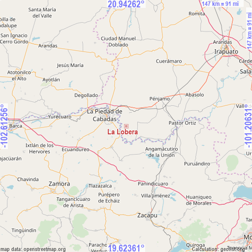
La Lobera GPS coordinates[2]
20° 17' 4.272" North, 101° 54' 33.948" West
| Map corner | latitude | longitude |
|---|---|---|
| Upper-left | 20.94262°, | -102.61256° |
| Center: | 20.28452°, | -101.90943° |
| Lower-right: | 19.62361°, | -101.20631° |
| Map W x H: | 146.7×146.7 km | = 91.2×91.2mi |
| max Lat: | 32.7° ⇑36.8% North |
| La Lobera: | 20.28452° |
| min Lat: | ⇓63.2% South 14.53588° |
| min Long | La Lobera | max Long |
| -117.105° | -101.90943° | -86.73105° |
| W 19.6%⇐ | ⇒80.4% E |
Elevation
Elevation of La Lobera is 1679 m = 5509 ft, and this is 425.3 m = 1395 ft above average elevation for this country.
| Max E: |
3497 m = 11473 ft | 42.4% |
| La Lobera | 1679 m 5509 ft | |
| Avg. | 1253.7 m = 4113 ft | |
Min E: |
-1 m = -3 ft | 57.6% |
See also: Mexico elevation on elevation.city.
Geographical zone
La Lobera is located in North Torrid zone (between Equator and Tropic of Cancer). Distance of this Northern Tropic circle is 350.5 km =217.8 mi to North.| Distance of | km | miles | from La Lobera |
|---|---|---|---|
| North Pole | 7751.6 | 4816.6 | to North |
| Arctic Circle | 5145.7 | 3197.4 | to North |
| Tropic Cancer | 350.5 | 217.8 | to North |
| Equator | 2255.4 | 1401.4 | to South |


Nearby cities:
15 places around La Lobera: (largest is in red/bold)
• Castillo de Villaseñor
6.7 km =4.2 mi,  92°
92°
• Cañada de Ramírez
5.8 km =3.6 mi,  283°
283°
• Cerritos Blancos
5.3 km =3.3 mi,  170°
170°
• Corral de Santiago
6.5 km =4 mi,  34°
34°
• Cruces de Rojas
4 km =2.5 mi,  152°
152°
• Cuevas de Morales
7 km =4.3 mi,  81°
81°
• El Infiernillo
7.2 km =4.5 mi,  103°
103°
• La Cal Grande
7.5 km =4.7 mi,  331°
331°
• La Estancia del Refugio
2.7 km =1.7 mi,  299°
299°
• Lagunillas
3.4 km =2.1 mi,  19°
19°
• Las Cañadas
7.3 km =4.5 mi, 281°
• Mezquite de Luna
2.3 km =1.4 mi,  50°
50°
• Numarán
5.3 km =3.3 mi,  232°
232°
• Palo Verde
7.6 km =4.7 mi,  55°
55°
• Veredas
6.8 km =4.2 mi,  116°
116°
Sources, notices
• [Note1] Compared only with cities in Mexico existing in our database
• [Src1] Map data: © OpenStreetMap contributors (CC-BY-SA)
• [Src2] Other city data from geonames.org with taken over terms of usage.
• [Src3] Geographical zone / Annual Mean Temperature by Robert A. Rohde @ Wikipedia
