La Estancia del Refugio geodata
La Estancia del Refugio (Guanajuato) is a populated place; located in Mexico in America/Mexico_City (GMT-6) time zone. With population of 750 people, there are 11679 cities with bigger population in this country. Compared to other cities in Mexico, 63.4% of cities are located further ↓South; 80.5% of cities are located further →East and 57.6% of cities have lower elevation than La Estancia del Refugio. Note1
Current local time in La Estancia del Refugio:
07:05 AM, WednesdayDifference from your time zone: hours


La Estancia del Refugio GPS coordinates[2]
20° 17' 46.5" North, 101° 55' 54.228" West
| Map corner | latitude | longitude |
|---|---|---|
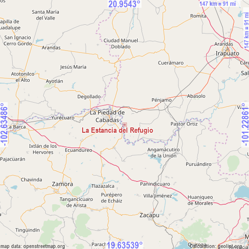
| Upper-left | 20.9543°, | -102.63486° |
| Center: | 20.29625°, | -101.93173° |
| Lower-right: | 19.63539°, | -101.22861° |
| Map W x H: | 146.6×146.7 km | = 91.1×91.2mi |
| max Lat: | 32.7° ⇑36.6% North |
| La Estancia del Refugio: | 20.29625° |
| min Lat: | ⇓63.4% South 14.53588° |
| min Long | La Estancia del | max Long |
| -117.105° | -101.93173° | -86.73105° |
| W 19.5%⇐ | ⇒80.5% E |
Elevation
Elevation of La Estancia del Refugio is 1679 m = 5509 ft, and this is 425.3 m = 1395 ft above average elevation for this country.
| Max E: |
3497 m = 11473 ft | 42.4% |
| La Estancia del Refugio | 1679 m 5509 ft | |
| Avg. | 1253.7 m = 4113 ft | |
Min E: |
-1 m = -3 ft | 57.6% |
See also: Mexico elevation on elevation.city.
Geographical zone
La Estancia del Refugio is located in North Torrid zone (between Equator and Tropic of Cancer). Distance of this Northern Tropic circle is 349.2 km =217 mi to North.| Distance of | km | miles | from La Estancia del Refugio |
|---|---|---|---|
| North Pole | 7750.3 | 4815.8 | to North |
| Arctic Circle | 5144.4 | 3196.6 | to North |
| Tropic Cancer | 349.2 | 217 | to North |
| Equator | 2256.7 | 1402.2 | to South |


Nearby cities:
15 places around La Estancia del Refugio: (largest is in red/bold)
• Cañada de Ramírez
3.3 km =2.1 mi,  270°
270°
• Cerritos Blancos
7.3 km =4.5 mi,  154°
154°
• Colonia Morelos
8.7 km =5.4 mi,  22°
22°
• Corral de Santiago
7.2 km =4.5 mi,  55°
55°
• Cruces de Rojas
6.4 km =4 mi,  139°
139°
• Guanajuatillo
8.3 km =5.2 mi,  302°
302°
• La Cal Grande
5.4 km =3.4 mi,  346°
346°
• La Lobera
2.7 km =1.7 mi,  119°
119°
• Lagunillas
4 km =2.5 mi, 61°
• Las Cañadas
4.8 km =3 mi, 271°
• Mezquite de Luna
4.1 km =2.5 mi,  87°
87°
• Numarán
4.9 km =3 mi,  202°
202°
• Palo Verde
9.1 km =5.7 mi,  70°
70°
• Villas de las Lomas
6 km =3.7 mi, 272°
• Zaragoza
6.2 km =3.9 mi,  328°
328°
Sources, notices
• [Note1] Compared only with cities in Mexico existing in our database
• [Src1] Map data: © OpenStreetMap contributors (CC-BY-SA)
• [Src2] Other city data from geonames.org with taken over terms of usage.
• [Src3] Geographical zone / Annual Mean Temperature by Robert A. Rohde @ Wikipedia
