Presa Blanca geodata
Presa Blanca (Guanajuato) is a populated place; located in Mexico in America/Mexico_City (GMT-6) time zone. With population of 1,881 people, there are 4622 cities with bigger population in this country. Compared to other cities in Mexico, 70.8% of cities are located further ↓South; 71.8% of cities are located further →East and 63.1% of cities have lower elevation than Presa Blanca. Note1


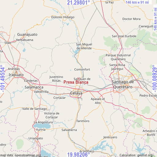
Presa Blanca GPS coordinates[2]
20° 38' 29.256" North, 100° 47' 32.676" West
| Map corner | latitude | longitude |
|---|---|---|
| Upper-left | 21.29801°, | -101.49554° |
| Center: | 20.64146°, | -100.79241° |
| Lower-right: | 19.98206°, | -100.08929° |
| Map W x H: | 146.3×146.3 km | = 90.9×90.9mi |
| max Lat: | 32.7° ⇑29.2% North |
| Presa Blanca: | 20.64146° |
| min Lat: | ⇓70.8% South 14.53588° |
| min Long | Presa Blanca | max Long |
| -117.105° | -100.79241° | -86.73105° |
| W 28.2%⇐ | ⇒71.8% E |
Elevation
Elevation of Presa Blanca is 1780 m = 5840 ft, and this is 526.3 m = 1727 ft above average elevation for this country.
| Max E: |
3497 m = 11473 ft | 36.9% |
| Presa Blanca | 1780 m 5840 ft | |
| Avg. | 1253.7 m = 4113 ft | |
Min E: |
-1 m = -3 ft | 63.1% |
See also: Mexico elevation on elevation.city.
Geographical zone
Presa Blanca is located in North Torrid zone (between Equator and Tropic of Cancer). Distance of this Northern Tropic circle is 310.8 km =193.1 mi to North.| Distance of | km | miles | from Presa Blanca |
|---|---|---|---|
| North Pole | 7711.9 | 4792 | to North |
| Arctic Circle | 5106.1 | 3172.8 | to North |
| Tropic Cancer | 310.8 | 193.1 | to North |
| Equator | 2295.1 | 1426.1 | to South |


Nearby cities:
15 places around Presa Blanca: (largest is in red/bold)
• Empalme Escobedo
5.9 km =3.7 mi,  54°
54°
• Guadalupe
4.8 km =3 mi,  72°
72°
• La Aurora
4 km =2.5 mi,  114°
114°
• La Concepción
2.9 km =1.8 mi,  184°
184°
• La Laguna
7 km =4.3 mi,  1°
1°
• Plancarte
6.1 km =3.8 mi, 183°
• San Antonio Espinoza
1.3 km =0.8 mi,  342°
342°
• San Antonio Gallardo
2.9 km =1.8 mi,  119°
119°
• San Cayetano
5.1 km =3.2 mi,  214°
214°
• San Elías
5.1 km =3.2 mi,  262°
262°
• San Isidro de la Concepción
1.7 km =1.1 mi,  155°
155°
• San José de la Presa
5.4 km =3.4 mi,  128°
128°
• San Juan de la Vega
3.7 km =2.3 mi, 119°
• Santa Teresa
6.8 km =4.2 mi,  267°
267°
• Tenería del Santuario
4.7 km =2.9 mi,  186°
186°
Sources, notices
• [Note1] Compared only with cities in Mexico existing in our database
• [Src1] Map data: © OpenStreetMap contributors (CC-BY-SA)
• [Src2] Other city data from geonames.org with taken over terms of usage.
• [Src3] Geographical zone / Annual Mean Temperature by Robert A. Rohde @ Wikipedia
