Jesús del Monte geodata
Jesús del Monte (Guanajuato) is a populated place; located in Mexico in America/Mexico_City (GMT-6) time zone. With population of 1,230 people, there are 7057 cities with bigger population in this country. Compared to other cities in Mexico, 75.1% of cities are located further ↓South; 79.3% of cities are located further →East and 62.9% of cities have lower elevation than Jesús del Monte. Note1


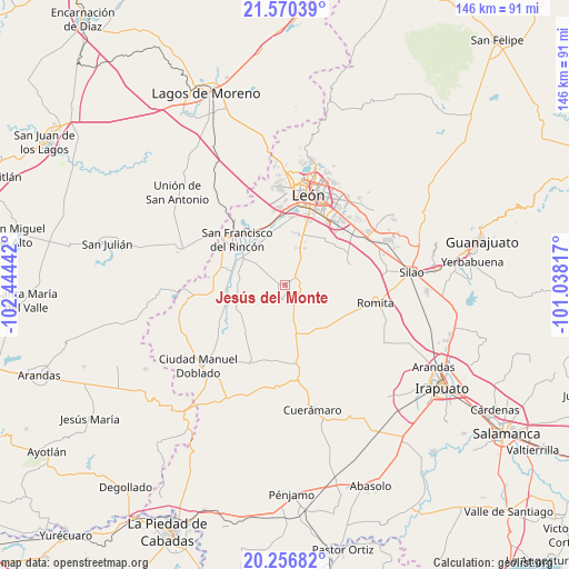
Jesús del Monte GPS coordinates[2]
20° 54' 54.144" North, 101° 44' 28.644" West
| Map corner | latitude | longitude |
|---|---|---|
| Upper-left | 21.57039°, | -102.44442° |
| Center: | 20.91504°, | -101.74129° |
| Lower-right: | 20.25682°, | -101.03817° |
| Map W x H: | 146.1×146.1 km | = 90.8×90.8mi |
| max Lat: | 32.7° ⇑24.9% North |
| Jesús del Monte: | 20.91504° |
| min Lat: | ⇓75.1% South 14.53588° |
| min Long | Jesús del Mont | max Long |
| -117.105° | -101.74129° | -86.73105° |
| W 20.7%⇐ | ⇒79.3% E |
Elevation
Elevation of Jesús del Monte is 1777 m = 5830 ft, and this is 523.3 m = 1717 ft above average elevation for this country.
| Max E: |
3497 m = 11473 ft | 37.1% |
| Jesús del Monte | 1777 m 5830 ft | |
| Avg. | 1253.7 m = 4113 ft | |
Min E: |
-1 m = -3 ft | 62.9% |
See also: Mexico elevation on elevation.city.
Geographical zone
Jesús del Monte is located in North Torrid zone (between Equator and Tropic of Cancer). Distance of this Northern Tropic circle is 280.4 km =174.2 mi to North.| Distance of | km | miles | from Jesús del Monte |
|---|---|---|---|
| North Pole | 7681.5 | 4773.1 | to North |
| Arctic Circle | 5075.6 | 3153.8 | to North |
| Tropic Cancer | 280.4 | 174.2 | to North |
| Equator | 2325.5 | 1445 | to South |


Nearby cities:
15 places around Jesús del Monte: (largest is in red/bold)
• Barretos
10.6 km =6.6 mi,  75°
75°
• Barrio de Guadalupe del Mezquitillo
7 km =4.3 mi,  297°
297°
• El Jaguey
11.1 km =6.9 mi,  90°
90°
• El Mezquitillo
8.7 km =5.4 mi,  306°
306°
• La Gloria
8.9 km =5.5 mi,  162°
162°
• La Sardina
8.8 km =5.5 mi,  115°
115°
• Loma de San Rafael
10.8 km =6.7 mi,  330°
330°
• Plan Guanajuato (La Sandía)
4.7 km =2.9 mi, 80°
• Plan Libertador
7.5 km =4.7 mi,  55°
55°
• San Carlos del Jagüey
11 km =6.8 mi, 92°
• San Cristóbal
8.2 km =5.1 mi,  31°
31°
• San Isidro de los Palominos
9.6 km =6 mi,  222°
222°
• San José de la Calera
7 km =4.3 mi,  341°
341°
• Sauz de Armenta
7.3 km =4.5 mi,  191°
191°
• Tortugas (Las Conchas)
7.6 km =4.7 mi,  280°
280°
Sources, notices
• [Note1] Compared only with cities in Mexico existing in our database
• [Src1] Map data: © OpenStreetMap contributors (CC-BY-SA)
• [Src2] Other city data from geonames.org with taken over terms of usage.
• [Src3] Geographical zone / Annual Mean Temperature by Robert A. Rohde @ Wikipedia
