Plan Libertador geodata
Plan Libertador (Guanajuato) is a populated place; located in Mexico in America/Mexico_City (GMT-6) time zone. With population of 508 people, there are 16554 cities with bigger population in this country. Compared to other cities in Mexico, 75.8% of cities are located further ↓South; 78.9% of cities are located further →East and 62.4% of cities have lower elevation than Plan Libertador. Note1


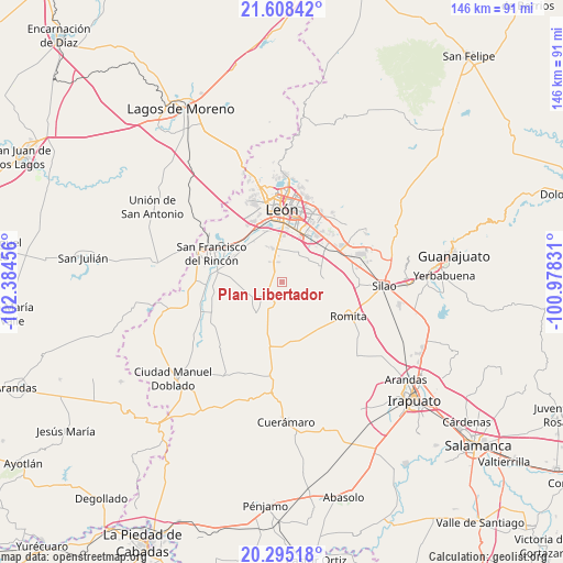
Plan Libertador GPS coordinates[2]
20° 57' 11.664" North, 101° 40' 53.148" West
| Map corner | latitude | longitude |
|---|---|---|
| Upper-left | 21.60842°, | -102.38456° |
| Center: | 20.95324°, | -101.68143° |
| Lower-right: | 20.29518°, | -100.97831° |
| Map W x H: | 146×146 km | = 90.7×90.7mi |
| max Lat: | 32.7° ⇑24.2% North |
| Plan Libertador: | 20.95324° |
| min Lat: | ⇓75.8% South 14.53588° |
| min Long | Plan Libertador | max Long |
| -117.105° | -101.68143° | -86.73105° |
| W 21.1%⇐ | ⇒78.9% E |
Elevation
Elevation of Plan Libertador is 1767 m = 5797 ft, and this is 513.3 m = 1684 ft above average elevation for this country.
| Max E: |
3497 m = 11473 ft | 37.6% |
| Plan Libertador | 1767 m 5797 ft | |
| Avg. | 1253.7 m = 4113 ft | |
Min E: |
-1 m = -3 ft | 62.4% |
See also: Mexico elevation on elevation.city.
Geographical zone
Plan Libertador is located in North Torrid zone (between Equator and Tropic of Cancer). Distance of this Northern Tropic circle is 276.1 km =171.6 mi to North.| Distance of | km | miles | from Plan Libertador |
|---|---|---|---|
| North Pole | 7677.3 | 4770.5 | to North |
| Arctic Circle | 5071.4 | 3151.2 | to North |
| Tropic Cancer | 276.1 | 171.6 | to North |
| Equator | 2329.8 | 1447.7 | to South |


Nearby cities:
15 places around Plan Libertador: (largest is in red/bold)
• Barretos
4.3 km =2.7 mi,  111°
111°
• El CERESO
7.7 km =4.8 mi,  354°
354°
• El Camaleón
8.9 km =5.5 mi,  145°
145°
• El Jaguey
6.5 km =4 mi,  130°
130°
• Jesús del Monte
7.5 km =4.7 mi,  235°
235°
• La Arcina
7.1 km =4.4 mi,  100°
100°
• La Sardina
8.2 km =5.1 mi,  167°
167°
• Los Ramírez
8.3 km =5.2 mi,  27°
27°
• Nuevo Lindero
4.6 km =2.9 mi,  82°
82°
• Plan Guanajuato (La Sandía)
3.9 km =2.4 mi,  204°
204°
• Rancho Nuevo de la Luz
3.8 km =2.4 mi,  74°
74°
• San Carlos del Jagüey
6.8 km =4.2 mi,  135°
135°
• San Cristóbal
3.3 km =2.1 mi,  325°
325°
• San Francisco de Durán
8.6 km =5.3 mi,  47°
47°
• San José de la Calera
8.8 km =5.5 mi,  285°
285°
Sources, notices
• [Note1] Compared only with cities in Mexico existing in our database
• [Src1] Map data: © OpenStreetMap contributors (CC-BY-SA)
• [Src2] Other city data from geonames.org with taken over terms of usage.
• [Src3] Geographical zone / Annual Mean Temperature by Robert A. Rohde @ Wikipedia
