Atotonilco geodata
Atotonilco (Michoacán) is a populated place; located in Mexico in America/Mexico_City (GMT-6) time zone. With population of 1,401 people, there are 6179 cities with bigger population in this country. Compared to other cities in Mexico, 55.8% of cities are located further ↓South; 66.7% of cities are located further →East and 87.4% of cities have lower elevation than Atotonilco. Note1


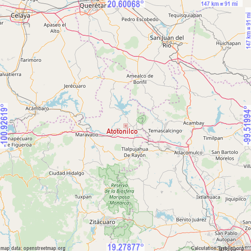
Atotonilco GPS coordinates[2]
19° 56' 27.996" North, 100° 13' 23.016" West
| Map corner | latitude | longitude |
|---|---|---|
| Upper-left | 20.60068°, | -100.92619° |
| Center: | 19.94111°, | -100.22306° |
| Lower-right: | 19.27877°, | -99.51994° |
| Map W x H: | 147×147 km | = 91.3×91.3mi |
| max Lat: | 32.7° ⇑44.2% North |
| Atotonilco: | 19.94111° |
| min Lat: | ⇓55.8% South 14.53588° |
| min Long | Atotonilco | max Long |
| -117.105° | -100.22306° | -86.73105° |
| W 33.3%⇐ | ⇒66.7% E |
Elevation
Elevation of Atotonilco is 2322 m = 7618 ft, and this is 1068.3 m = 3505 ft above average elevation for this country.
| Max E: |
3497 m = 11473 ft | 12.6% |
| Atotonilco | 2322 m 7618 ft | |
| Avg. | 1253.7 m = 4113 ft | |
Min E: |
-1 m = -3 ft | 87.4% |
See also: Mexico elevation on elevation.city.
Geographical zone
Atotonilco is located in North Torrid zone (between Equator and Tropic of Cancer). Distance of this Northern Tropic circle is 388.7 km =241.5 mi to North.| Distance of | km | miles | from Atotonilco |
|---|---|---|---|
| North Pole | 7789.8 | 4840.4 | to North |
| Arctic Circle | 5183.9 | 3221.1 | to North |
| Tropic Cancer | 388.7 | 241.5 | to North |
| Equator | 2217.2 | 1377.7 | to South |


Nearby cities:
15 places around Atotonilco: (largest is in red/bold)
• Agua Caliente
7 km =4.3 mi,  130°
130°
• Buenavista
3.2 km =2 mi,  193°
193°
• Contepec
6.4 km =4 mi,  76°
76°
• El Capulín
10.3 km =6.4 mi, 133°
• El Césped
10.9 km =6.8 mi, 126°
• El Encino
6.5 km =4 mi,  119°
119°
• El Gigante
10.6 km =6.6 mi,  163°
163°
• La Higuerilla (Los Lirios)
5.9 km =3.7 mi,  249°
249°
• La Huerta
10.2 km =6.3 mi,  216°
216°
• Las Tenerías (Las Tenerías de Tepetongo)
11.2 km =7 mi,  111°
111°
• Llano Largo (Santa Rosa de Lima)
9.9 km =6.2 mi,  21°
21°
• San Ramón
5.9 km =3.7 mi, 218°
• Tepetongo
10 km =6.2 mi, 111°
• Tepuxtepec
5.6 km =3.5 mi,  357°
357°
• Venta de Bravo
10.1 km =6.3 mi,  148°
148°
Sources, notices
• [Note1] Compared only with cities in Mexico existing in our database
• [Src1] Map data: © OpenStreetMap contributors (CC-BY-SA)
• [Src2] Other city data from geonames.org with taken over terms of usage.
• [Src3] Geographical zone / Annual Mean Temperature by Robert A. Rohde @ Wikipedia
