Llano Grande geodata
Llano Grande (Michoacán) is a populated place; located in Mexico in America/Mexico_City (GMT-6) time zone. With population of 643 people, there are 13457 cities with bigger population in this country. Compared to other cities in Mexico, 53.9% of cities are located further ↓South; 67.8% of cities are located further →East and 83.2% of cities have lower elevation than Llano Grande. Note1


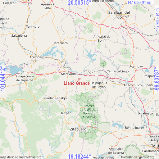
Llano Grande GPS coordinates[2]
19° 50' 42.612" North, 100° 20' 27.564" West
| Map corner | latitude | longitude |
|---|---|---|
| Upper-left | 20.50515°, | -101.04412° |
| Center: | 19.84517°, | -100.34099° |
| Lower-right: | 19.18244°, | -99.63787° |
| Map W x H: | 147.1×147.1 km | = 91.4×91.4mi |
| max Lat: | 32.7° ⇑46.1% North |
| Llano Grande: | 19.84517° |
| min Lat: | ⇓53.9% South 14.53588° |
| min Long | Llano Grande | max Long |
| -117.105° | -100.34099° | -86.73105° |
| W 32.2%⇐ | ⇒67.8% E |
Elevation
Elevation of Llano Grande is 2224 m = 7297 ft, and this is 970.3 m = 3183 ft above average elevation for this country.
| Max E: |
3497 m = 11473 ft | 16.8% |
| Llano Grande | 2224 m 7297 ft | |
| Avg. | 1253.7 m = 4113 ft | |
Min E: |
-1 m = -3 ft | 83.2% |
See also: Mexico elevation on elevation.city.
Geographical zone
Llano Grande is located in North Torrid zone (between Equator and Tropic of Cancer). Distance of this Northern Tropic circle is 399.3 km =248.1 mi to North.| Distance of | km | miles | from Llano Grande |
|---|---|---|---|
| North Pole | 7800.5 | 4847 | to North |
| Arctic Circle | 5194.6 | 3227.8 | to North |
| Tropic Cancer | 399.3 | 248.1 | to North |
| Equator | 2206.6 | 1371.1 | to South |


Nearby cities:
15 places around Llano Grande: (largest is in red/bold)
• Apeo
4.7 km =2.9 mi,  358°
358°
• Cachivi
4.7 km =2.9 mi,  202°
202°
• Campo Hermoso
6.7 km =4.2 mi,  268°
268°
• Colonia Huandishi (Las Chinches)
7.5 km =4.7 mi,  348°
348°
• El Tejero
6.2 km =3.9 mi,  302°
302°
• José María Morelos
6.7 km =4.2 mi, 204°
• La Huerta
6.7 km =4.2 mi,  68°
68°
• Milpillas
6.2 km =3.9 mi,  158°
158°
• Pomoquita
5.4 km =3.4 mi,  330°
330°
• San José Soto
7.1 km =4.4 mi,  174°
174°
• San Miguel el Alto (El Puerto)
8.6 km =5.3 mi,  89°
89°
• Santa Elena
7.2 km =4.5 mi,  281°
281°
• Segunda Manzana de Chincua
8.4 km =5.2 mi,  146°
146°
• Tungareo
7.5 km =4.7 mi,  339°
339°
• Tupátaro
5.1 km =3.2 mi,  133°
133°
Sources, notices
• [Note1] Compared only with cities in Mexico existing in our database
• [Src1] Map data: © OpenStreetMap contributors (CC-BY-SA)
• [Src2] Other city data from geonames.org with taken over terms of usage.
• [Src3] Geographical zone / Annual Mean Temperature by Robert A. Rohde @ Wikipedia
