Apeo geodata
Apeo (Michoacán) is a populated place; located in Mexico in America/Mexico_City (GMT-6) time zone. With population of 1,897 people, there are 4587 cities with bigger population in this country. Compared to other cities in Mexico, 54.8% of cities are located further ↓South; 67.8% of cities are located further →East and 75.1% of cities have lower elevation than Apeo. Note1


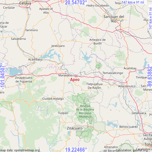
Apeo GPS coordinates[2]
19° 53' 13.992" North, 100° 20' 30.984" West
| Map corner | latitude | longitude |
|---|---|---|
| Upper-left | 20.54702°, | -101.04507° |
| Center: | 19.88722°, | -100.34194° |
| Lower-right: | 19.22466°, | -99.63882° |
| Map W x H: | 147×147 km | = 91.3×91.3mi |
| max Lat: | 32.7° ⇑45.2% North |
| Apeo: | 19.88722° |
| min Lat: | ⇓54.8% South 14.53588° |
| min Long | Apeo | max Long |
| -117.105° | -100.34194° | -86.73105° |
| W 32.2%⇐ | ⇒67.8% E |
Elevation
Elevation of Apeo is 2033 m = 6670 ft, and this is 779.3 m = 2557 ft above average elevation for this country.
| Max E: |
3497 m = 11473 ft | 24.9% |
| Apeo | 2033 m 6670 ft | |
| Avg. | 1253.7 m = 4113 ft | |
Min E: |
-1 m = -3 ft | 75.1% |
See also: Mexico elevation on elevation.city.
Geographical zone
Apeo is located in North Torrid zone (between Equator and Tropic of Cancer). Distance of this Northern Tropic circle is 394.7 km =245.3 mi to North.| Distance of | km | miles | from Apeo |
|---|---|---|---|
| North Pole | 7795.8 | 4844.1 | to North |
| Arctic Circle | 5189.9 | 3224.9 | to North |
| Tropic Cancer | 394.7 | 245.3 | to North |
| Equator | 2211.3 | 1374 | to South |


Nearby cities:
15 places around Apeo: (largest is in red/bold)
• Cachivi
9.1 km =5.7 mi,  190°
190°
• Campo Hermoso
8.2 km =5.1 mi,  233°
233°
• Colonia Huandishi (Las Chinches)
3 km =1.9 mi,  331°
331°
• Colonia Yurécuaro
10 km =6.2 mi,  293°
293°
• El Tejero
5.3 km =3.3 mi,  255°
255°
• La Higuerilla (Los Lirios)
7.9 km =4.9 mi,  60°
60°
• La Huerta
6.7 km =4.2 mi,  108°
108°
• Llano Grande
4.7 km =2.9 mi,  178°
178°
• Milpillas
10.7 km =6.6 mi,  166°
166°
• Pomoquita
2.6 km =1.6 mi,  270°
270°
• San Miguel el Alto (El Puerto)
9.8 km =6.1 mi,  117°
117°
• San Ramón
8.9 km =5.5 mi,  80°
80°
• Santa Elena
7.6 km =4.7 mi,  245°
245°
• Tungareo
3.5 km =2.2 mi,  312°
312°
• Tupátaro
9 km =5.6 mi,  154°
154°
Sources, notices
• [Note1] Compared only with cities in Mexico existing in our database
• [Src1] Map data: © OpenStreetMap contributors (CC-BY-SA)
• [Src2] Other city data from geonames.org with taken over terms of usage.
• [Src3] Geographical zone / Annual Mean Temperature by Robert A. Rohde @ Wikipedia
