La Huerta geodata
La Huerta (Michoacán) is a populated place; located in Mexico in America/Mexico_City (GMT-6) time zone. With population of 586 people, there are 14641 cities with bigger population in this country. Compared to other cities in Mexico, 54.4% of cities are located further ↓South; 67.2% of cities are located further →East and 82.1% of cities have lower elevation than La Huerta. Note1


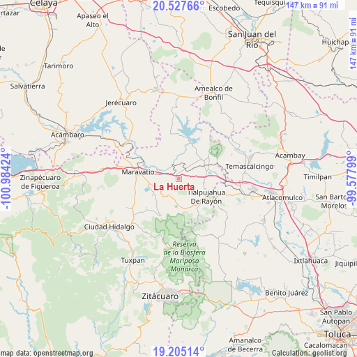
La Huerta GPS coordinates[2]
19° 52' 4.008" North, 100° 16' 51.996" West
| Map corner | latitude | longitude |
|---|---|---|
| Upper-left | 20.52766°, | -100.98424° |
| Center: | 19.86778°, | -100.28111° |
| Lower-right: | 19.20514°, | -99.57799° |
| Map W x H: | 147.1×147.1 km | = 91.4×91.4mi |
| max Lat: | 32.7° ⇑45.6% North |
| La Huerta: | 19.86778° |
| min Lat: | ⇓54.4% South 14.53588° |
| min Long | La Huerta | max Long |
| -117.105° | -100.28111° | -86.73105° |
| W 32.8%⇐ | ⇒67.2% E |
Elevation
Elevation of La Huerta is 2191 m = 7188 ft, and this is 937.3 m = 3075 ft above average elevation for this country.
| Max E: |
3497 m = 11473 ft | 17.9% |
| La Huerta | 2191 m 7188 ft | |
| Avg. | 1253.7 m = 4113 ft | |
Min E: |
-1 m = -3 ft | 82.1% |
See also: Mexico elevation on elevation.city.
Geographical zone
La Huerta is located in North Torrid zone (between Equator and Tropic of Cancer). Distance of this Northern Tropic circle is 396.8 km =246.6 mi to North.| Distance of | km | miles | from La Huerta |
|---|---|---|---|
| North Pole | 7798 | 4845.5 | to North |
| Arctic Circle | 5192.1 | 3226.2 | to North |
| Tropic Cancer | 396.8 | 246.6 | to North |
| Equator | 2209.1 | 1372.7 | to South |


Nearby cities:
15 places around La Huerta: (largest is in red/bold)
• Apeo
6.7 km =4.2 mi,  288°
288°
• Buenavista
7.4 km =4.6 mi,  46°
46°
• Colonia Huandishi (Las Chinches)
9.1 km =5.7 mi,  301°
301°
• El Gigante
9.2 km =5.7 mi,  102°
102°
• La Higuerilla (Los Lirios)
6.1 km =3.8 mi,  4°
4°
• Llano Grande
6.7 km =4.2 mi,  248°
248°
• Milpillas
9.1 km =5.7 mi,  205°
205°
• Pomoquita
9.2 km =5.7 mi,  283°
283°
• San Miguel el Alto (El Puerto)
3.4 km =2.1 mi,  135°
135°
• San Pedro Tarímbaro
8.8 km =5.5 mi, 138°
• San Ramón
4.3 km =2.7 mi,  33°
33°
• Sandía
9.7 km =6 mi,  126°
126°
• Segunda Manzana de Chincua
9.7 km =6 mi,  189°
189°
• Tungareo
10 km =6.2 mi, 296°
• Tupátaro
6.5 km =4 mi,  202°
202°
Sources, notices
• [Note1] Compared only with cities in Mexico existing in our database
• [Src1] Map data: © OpenStreetMap contributors (CC-BY-SA)
• [Src2] Other city data from geonames.org with taken over terms of usage.
• [Src3] Geographical zone / Annual Mean Temperature by Robert A. Rohde @ Wikipedia
