Cerro del Campo geodata
Cerro del Campo (State of Mexico) is a populated place; located in Mexico in America/Mexico_City (GMT-6) time zone. With population of 565 people, there are 15122 cities with bigger population in this country. Compared to other cities in Mexico, 70.7% of cities are located further ↑North; 67% of cities are located further →East and 59.8% of cities have higher elevation than Cerro del Campo. Note1


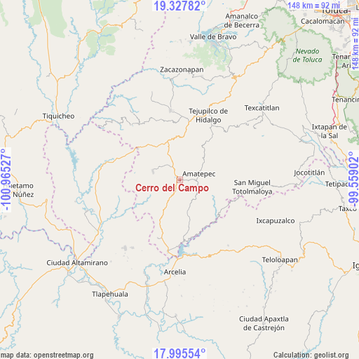
Cerro del Campo GPS coordinates[2]
18° 39' 46.764" North, 100° 15' 43.704" West
| Map corner | latitude | longitude |
|---|---|---|
| Upper-left | 19.32782°, | -100.96527° |
| Center: | 18.66299°, | -100.26214° |
| Lower-right: | 17.99554°, | -99.55902° |
| Map W x H: | 148.1×148.1 km | = 92×92mi |
| max Lat: | 32.7° ⇑70.7% North |
| Cerro del Campo: | 18.66299° |
| min Lat: | ⇓29.3% South 14.53588° |
| min Long | Cerro del Campo | max Long |
| -117.105° | -100.26214° | -86.73105° |
| W 33%⇐ | ⇒67% E |
Elevation
Elevation of Cerro del Campo is 1014 m = 3327 ft, and this is 239.7 m = 786 ft below average elevation for this country.
| Max E: |
3497 m = 11473 ft | 59.8% |
| Avg. | 1253.7 m = 4113 ft | |
| Cerro del Campo | 1014 m = 3327 ft | |
Min E: |
-1 m = -3 ft | 40.2% |
See also: Mexico elevation on elevation.city.
Geographical zone
Cerro del Campo is located in North Torrid zone (between Equator and Tropic of Cancer). Distance of this Northern Tropic circle is 530.8 km =329.8 mi to North.| Distance of | km | miles | from Cerro del Campo |
|---|---|---|---|
| North Pole | 7931.9 | 4928.7 | to North |
| Arctic Circle | 5326 | 3309.4 | to North |
| Tropic Cancer | 530.8 | 329.8 | to North |
| Equator | 2075.1 | 1289.4 | to South |


Nearby cities:
15 places around Cerro del Campo: (largest is in red/bold)
• Amatepec
8.3 km =5.2 mi,  75°
75°
• El Rancho
2.6 km =1.6 mi,  318°
318°
• Mayaltepec
14.5 km =9 mi,  231°
231°
• Palmar Chico
11.8 km =7.3 mi,  288°
288°
• Palmar Grande
18 km =11.2 mi,  239°
239°
• San Francisco de Asís
4.5 km =2.8 mi,  205°
205°
• San Juan Tetitlán
9 km =5.6 mi,  131°
131°
• San Mateo (San Mateo Guayatenco)
12.2 km =7.6 mi,  105°
105°
• San Miguel Ixtapan
19.8 km =12.3 mi,  35°
35°
• San Pedro Limón
10.2 km =6.3 mi, 207°
• San Simón
13.1 km =8.1 mi, 44°
• Santa Ana Zicatecoyan
11.1 km =6.9 mi,  156°
156°
• Santa María
17.7 km =11 mi, 112°
• Tlacocuspan
7.7 km =4.8 mi, 230°
• Tlatlaya
7.6 km =4.7 mi, 131°
Sources, notices
• [Note1] Compared only with cities in Mexico existing in our database
• [Src1] Map data: © OpenStreetMap contributors (CC-BY-SA)
• [Src2] Other city data from geonames.org with taken over terms of usage.
• [Src3] Geographical zone / Annual Mean Temperature by Robert A. Rohde @ Wikipedia
