Ranchería la Ciénega geodata
Ranchería la Ciénega (State of Mexico) is a populated place; located in Mexico in America/Mexico_City (GMT-6) time zone. With population of 730 people, there are 11957 cities with bigger population in this country. Compared to other cities in Mexico, 51.1% of cities are located further ↑North; 64.6% of cities are located further →East and 97.4% of cities have lower elevation than Ranchería la Ciénega. Note1


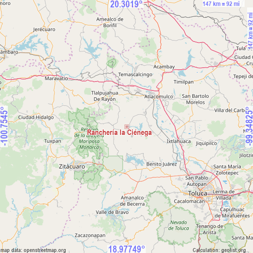
Ranchería la Ciénega GPS coordinates[2]
19° 38' 27.816" North, 100° 3' 4.932" West
| Map corner | latitude | longitude |
|---|---|---|
| Upper-left | 20.3019°, | -100.7545° |
| Center: | 19.64106°, | -100.05137° |
| Lower-right: | 18.97749°, | -99.34825° |
| Map W x H: | 147.3×147.3 km | = 91.5×91.5mi |
| max Lat: | 32.7° ⇑51.1% North |
| Ranchería la Ciénega: | 19.64106° |
| min Lat: | ⇓48.9% South 14.53588° |
| min Long | Ranchería la C | max Long |
| -117.105° | -100.05137° | -86.73105° |
| W 35.4%⇐ | ⇒64.6% E |
Elevation
Elevation of Ranchería la Ciénega is 2708 m = 8885 ft, and this is 1454.3 m = 4771 ft above average elevation for this country.
| Max E: |
3497 m = 11473 ft | 2.6% |
| Ranchería la Ciénega | 2708 m 8885 ft | |
| Avg. | 1253.7 m = 4113 ft | |
Min E: |
-1 m = -3 ft | 97.4% |
See also: Mexico elevation on elevation.city.
Geographical zone
Ranchería la Ciénega is located in North Torrid zone (between Equator and Tropic of Cancer). Distance of this Northern Tropic circle is 422 km =262.2 mi to North.| Distance of | km | miles | from Ranchería la Ciénega |
|---|---|---|---|
| North Pole | 7823.2 | 4861.1 | to North |
| Arctic Circle | 5217.3 | 3241.9 | to North |
| Tropic Cancer | 422 | 262.2 | to North |
| Equator | 2183.9 | 1357 | to South |


Nearby cities:
15 places around Ranchería la Ciénega: (largest is in red/bold)
• Barrio la Mesa, Rioyos Buenavista
7.1 km =4.4 mi,  354°
354°
• Calvario del Carmen
4.3 km =2.7 mi,  98°
98°
• Dios Padre
3.3 km =2.1 mi,  205°
205°
• Dotegiare
7.4 km =4.6 mi,  6°
6°
• Ejido la Soledad
5.8 km =3.6 mi,  274°
274°
• Ejido la Virgen
4.9 km =3 mi,  182°
182°
• El Valerio
5.1 km =3.2 mi,  283°
283°
• Estutempan
7 km =4.3 mi,  80°
80°
• Guadalupe del Pedregal la Palma
7.5 km =4.7 mi,  302°
302°
• Loma del Rancho
5.3 km =3.3 mi, 209°
• Purísima Concepción Mayorazgo
7.6 km =4.7 mi,  42°
42°
• San Miguel Agua Bendita
3.2 km =2 mi,  247°
247°
• San Nicolás Guadalupe
3.7 km =2.3 mi,  144°
144°
• Santa Cruz del Rincón
7.1 km =4.4 mi,  294°
294°
• Tres Estrellas
6.7 km =4.2 mi,  153°
153°
Sources, notices
• [Note1] Compared only with cities in Mexico existing in our database
• [Src1] Map data: © OpenStreetMap contributors (CC-BY-SA)
• [Src2] Other city data from geonames.org with taken over terms of usage.
• [Src3] Geographical zone / Annual Mean Temperature by Robert A. Rohde @ Wikipedia
