San Cayetano geodata
San Cayetano (State of Mexico) is a populated place; located in Mexico in America/Mexico_City (GMT-6) time zone. With population of 935 people, there are 9320 cities with bigger population in this country. Compared to other cities in Mexico, 56.9% of cities are located further ↑North; 65.1% of cities are located further →East and 92.9% of cities have lower elevation than San Cayetano. Note1


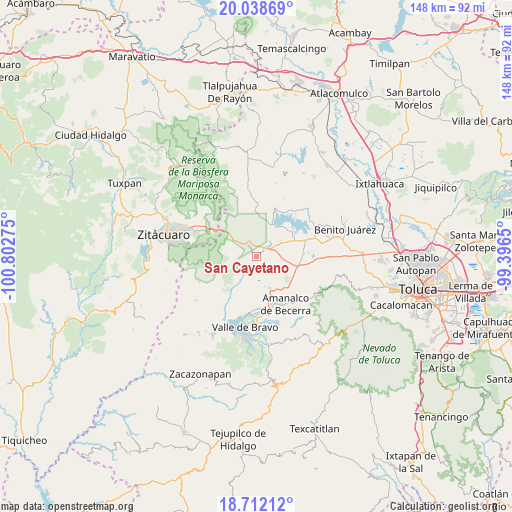
San Cayetano GPS coordinates[2]
19° 22' 36.336" North, 100° 5' 58.632" West
| Map corner | latitude | longitude |
|---|---|---|
| Upper-left | 20.03869°, | -100.80275° |
| Center: | 19.37676°, | -100.09962° |
| Lower-right: | 18.71212°, | -99.3965° |
| Map W x H: | 147.5×147.5 km | = 91.7×91.7mi |
| max Lat: | 32.7° ⇑56.9% North |
| San Cayetano: | 19.37676° |
| min Lat: | ⇓43.1% South 14.53588° |
| min Long | San Cayetano | max Long |
| -117.105° | -100.09962° | -86.73105° |
| W 34.9%⇐ | ⇒65.1% E |
Elevation
Elevation of San Cayetano is 2522 m = 8274 ft, and this is 1268.3 m = 4161 ft above average elevation for this country.
| Max E: |
3497 m = 11473 ft | 7.1% |
| San Cayetano | 2522 m 8274 ft | |
| Avg. | 1253.7 m = 4113 ft | |
Min E: |
-1 m = -3 ft | 92.9% |
See also: Mexico elevation on elevation.city.
Geographical zone
San Cayetano is located in North Torrid zone (between Equator and Tropic of Cancer). Distance of this Northern Tropic circle is 451.4 km =280.5 mi to North.| Distance of | km | miles | from San Cayetano |
|---|---|---|---|
| North Pole | 7852.6 | 4879.4 | to North |
| Arctic Circle | 5246.7 | 3260.1 | to North |
| Tropic Cancer | 451.4 | 280.5 | to North |
| Equator | 2154.5 | 1338.7 | to South |


Nearby cities:
15 places around San Cayetano: (largest is in red/bold)
• Barrio el Boncho
5.5 km =3.4 mi,  352°
352°
• Barrio la Joya
4.8 km =3 mi,  359°
359°
• Barrio los Tules
6.4 km =4 mi,  24°
24°
• Cabecera de Indígenas
3.9 km =2.4 mi,  262°
262°
• El Jacal
3.3 km =2.1 mi, 18°
• Loma de Juárez
6.6 km =4.1 mi,  8°
8°
• Los Berros
5.9 km =3.7 mi,  66°
66°
• Ranchería de San Martín Obispo
5.8 km =3.6 mi,  170°
170°
• Sabana del Madroño (El Madroño)
6.2 km =3.9 mi,  120°
120°
• San Felipe Santiago
1.7 km =1.1 mi,  334°
334°
• San Francisco de Asís
4.8 km =3 mi, 328°
• San Ildefonso
5.1 km =3.2 mi,  232°
232°
• San Isidro
1.9 km =1.2 mi, 22°
• San José Villa de Allende
5.1 km =3.2 mi,  268°
268°
• San Pablo Malacatepec
6 km =3.7 mi, 265°
Sources, notices
• [Note1] Compared only with cities in Mexico existing in our database
• [Src1] Map data: © OpenStreetMap contributors (CC-BY-SA)
• [Src2] Other city data from geonames.org with taken over terms of usage.
• [Src3] Geographical zone / Annual Mean Temperature by Robert A. Rohde @ Wikipedia
