San Miguel Tecomatlán geodata
San Miguel Tecomatlán (Guerrero) is a populated place; located in Mexico in America/Mexico_City (GMT-6) time zone. With population of 955 people, there are 9122 cities with bigger population in this country. Compared to other cities in Mexico, 74.7% of cities are located further ↑North; 68.5% of cities are located further →East and 72% of cities have higher elevation than San Miguel Tecomatlán. Note1


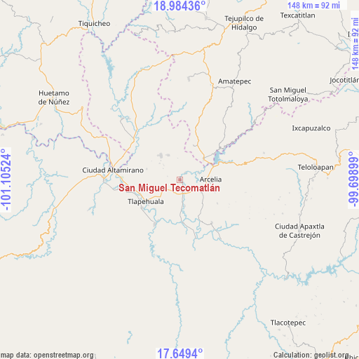
San Miguel Tecomatlán GPS coordinates[2]
18° 19' 5.412" North, 100° 24' 7.596" West
| Map corner | latitude | longitude |
|---|---|---|
| Upper-left | 18.98436°, | -101.10524° |
| Center: | 18.31817°, | -100.40211° |
| Lower-right: | 17.6494°, | -99.69899° |
| Map W x H: | 148.4×148.4 km | = 92.2×92.2mi |
| max Lat: | 32.7° ⇑74.7% North |
| San Miguel Tecomatlán: | 18.31817° |
| min Lat: | ⇓25.3% South 14.53588° |
| min Long | San Miguel Teco | max Long |
| -117.105° | -100.40211° | -86.73105° |
| W 31.5%⇐ | ⇒68.5% E |
Elevation
Elevation of San Miguel Tecomatlán is 328 m = 1076 ft, and this is 925.7 m = 3037 ft below average elevation for this country.
| Max E: |
3497 m = 11473 ft | 72% |
| Avg. | 1253.7 m = 4113 ft | |
| San Miguel Tecomatlán | 328 m = 1076 ft | |
Min E: |
-1 m = -3 ft | 28% |
See also: Mexico elevation on elevation.city.
Geographical zone
San Miguel Tecomatlán is located in North Torrid zone (between Equator and Tropic of Cancer). Distance of this Northern Tropic circle is 569.1 km =353.6 mi to North.| Distance of | km | miles | from San Miguel Tecomatlán |
|---|---|---|---|
| North Pole | 7970.3 | 4952.5 | to North |
| Arctic Circle | 5364.4 | 3333.3 | to North |
| Tropic Cancer | 569.1 | 353.6 | to North |
| Equator | 2036.8 | 1265.6 | to South |


Nearby cities:
15 places around San Miguel Tecomatlán: (largest is in red/bold)
• Arcelia
12.7 km =7.9 mi,  89°
89°
• Colonia Emperador Cuauhtémoc
11.8 km =7.3 mi,  102°
102°
• Colonia Juárez (El Jabalí)
7.5 km =4.7 mi,  236°
236°
• Cuauhlotitlán
8.4 km =5.2 mi,  68°
68°
• El Naranjo
13.8 km =8.6 mi,  59°
59°
• El Temblor
12.7 km =7.9 mi,  50°
50°
• Reforma de Lázaro Cárdenas (El Aterrizaje)
12.6 km =7.8 mi, 102°
• Rincón del Gallo (San José Guadalupe)
12.2 km =7.6 mi,  246°
246°
• San Antonio de las Huertas
12.9 km =8 mi, 251°
• San Antonio del Rosario
13.4 km =8.3 mi, 47°
• San Bartolo
10.8 km =6.7 mi,  169°
169°
• San José Poliutla
5.2 km =3.2 mi, 166°
• Santo Niño
9 km =5.6 mi,  113°
113°
• Tlalchapa
12.9 km =8 mi,  322°
322°
• Villa Madero
11.4 km =7.1 mi,  334°
334°
Sources, notices
• [Note1] Compared only with cities in Mexico existing in our database
• [Src1] Map data: © OpenStreetMap contributors (CC-BY-SA)
• [Src2] Other city data from geonames.org with taken over terms of usage.
• [Src3] Geographical zone / Annual Mean Temperature by Robert A. Rohde @ Wikipedia
