Reforma de Lázaro Cárdenas (El Aterrizaje) geodata
Reforma de Lázaro Cárdenas (El Aterrizaje) (Guerrero) is a populated place; located in Mexico in America/Mexico_City (GMT-6) time zone. With population of 612 people, there are 14088 cities with bigger population in this country. Compared to other cities in Mexico, 75% of cities are located further ↑North; 67.2% of cities are located further →East and 70% of cities have higher elevation than Reforma de Lázaro Cárdenas (El Aterrizaje). Note1
Current local time in Reforma de Lázaro Cárdenas (El Aterrizaje):
12:56 PM, MondayDifference from your time zone: hours


Reforma de Lázaro Cárdenas (El Aterrizaje) GPS coordinates[2]
18° 17' 35.988" North, 100° 17' 8.988" West
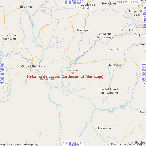
| Map corner | latitude | longitude |
|---|---|---|
| Upper-left | 18.95962°, | -100.98896° |
| Center: | 18.29333°, | -100.28583° |
| Lower-right: | 17.62447°, | -99.58271° |
| Map W x H: | 148.5×148.5 km | = 92.3×92.3mi |
| max Lat: | 32.7° ⇑75% North |
| Reforma de Lázaro Cárdenas (El Aterrizaje): | 18.29333° |
| min Lat: | ⇓25% South 14.53588° |
| min Long | Reforma de Láz | max Long |
| -117.105° | -100.28583° | -86.73105° |
| W 32.8%⇐ | ⇒67.2% E |
Elevation
Elevation of Reforma de Lázaro Cárdenas (El Aterrizaje) is 418 m = 1371 ft, and this is 835.7 m = 2742 ft below average elevation for this country.
| Max E: |
3497 m = 11473 ft | 70% |
| Avg. | 1253.7 m = 4113 ft | |
| Reforma de Lázaro Cárdenas (El Aterrizaje) | 418 m = 1371 ft | |
Min E: |
-1 m = -3 ft | 30% |
See also: Mexico elevation on elevation.city.
Geographical zone
Reforma de Lázaro Cárdenas (El Aterrizaje) is located in North Torrid zone (between Equator and Tropic of Cancer). Distance of this Northern Tropic circle is 571.9 km =355.4 mi to North.| Distance of | km | miles | from Reforma de Lázaro Cárdenas (El Aterrizaje) |
|---|---|---|---|
| North Pole | 7973 | 4954.2 | to North |
| Arctic Circle | 5367.1 | 3335 | to North |
| Tropic Cancer | 571.9 | 355.4 | to North |
| Equator | 2034 | 1263.9 | to South |


Nearby cities:
15 places around Reforma de Lázaro Cárdenas (El Aterrizaje): (largest is in red/bold)
• Arcelia
2.8 km =1.7 mi,  9°
9°
• Colonia Emperador Cuauhtémoc
0.8 km =0.5 mi,  278°
278°
• Cuauhlotitlán
7.4 km =4.6 mi,  322°
322°
• El Aguaje
13.3 km =8.3 mi,  215°
215°
• El Escondido
8.5 km =5.3 mi,  198°
198°
• El Naranjo
9.9 km =6.2 mi,  357°
357°
• El Remance
13.8 km =8.6 mi, 201°
• El Temblor
11.2 km =7 mi,  347°
347°
• Nuevo Copaltepec
10.2 km =6.3 mi, 359°
• Palos Altos
8.7 km =5.4 mi, 8°
• San Antonio del Rosario
12.1 km =7.5 mi, 348°
• San Bartolo
13 km =8.1 mi,  232°
232°
• San José Poliutla
11.3 km =7 mi,  258°
258°
• San Miguel Tecomatlán
12.6 km =7.8 mi, 282°
• Santo Niño
4.1 km =2.5 mi, 259°
Sources, notices
• [Note1] Compared only with cities in Mexico existing in our database
• [Src1] Map data: © OpenStreetMap contributors (CC-BY-SA)
• [Src2] Other city data from geonames.org with taken over terms of usage.
• [Src3] Geographical zone / Annual Mean Temperature by Robert A. Rohde @ Wikipedia
