El Paraíso geodata
El Paraíso (Querétaro) is a populated place; located in Mexico in America/Mexico_City (GMT-6) time zone. With population of 1,210 people, there are 7193 cities with bigger population in this country. Compared to other cities in Mexico, 69.2% of cities are located further ↓South; 66.6% of cities are located further →East and 69.3% of cities have lower elevation than El Paraíso. Note1


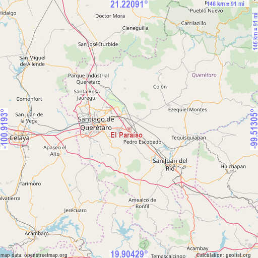
El Paraíso GPS coordinates[2]
20° 33' 50.472" North, 100° 12' 58.212" West
| Map corner | latitude | longitude |
|---|---|---|
| Upper-left | 21.22091°, | -100.9193° |
| Center: | 20.56402°, | -100.21617° |
| Lower-right: | 19.90429°, | -99.51305° |
| Map W x H: | 146.4×146.4 km | = 91×91mi |
| max Lat: | 32.7° ⇑30.8% North |
| El Paraíso: | 20.56402° |
| min Lat: | ⇓69.2% South 14.53588° |
| min Long | El Paraíso | max Long |
| -117.105° | -100.21617° | -86.73105° |
| W 33.4%⇐ | ⇒66.6% E |
Elevation
Elevation of El Paraíso is 1913 m = 6276 ft, and this is 659.3 m = 2163 ft above average elevation for this country.
| Max E: |
3497 m = 11473 ft | 30.7% |
| El Paraíso | 1913 m 6276 ft | |
| Avg. | 1253.7 m = 4113 ft | |
Min E: |
-1 m = -3 ft | 69.3% |
See also: Mexico elevation on elevation.city.
Geographical zone
El Paraíso is located in North Torrid zone (between Equator and Tropic of Cancer). Distance of this Northern Tropic circle is 319.4 km =198.5 mi to North.| Distance of | km | miles | from El Paraíso |
|---|---|---|---|
| North Pole | 7720.6 | 4797.4 | to North |
| Arctic Circle | 5114.7 | 3178.1 | to North |
| Tropic Cancer | 319.4 | 198.5 | to North |
| Equator | 2286.5 | 1420.8 | to South |


Nearby cities:
15 places around El Paraíso: (largest is in red/bold)
• Agua Azul
4.5 km =2.8 mi,  15°
15°
• Calamanda
3.7 km =2.3 mi,  121°
121°
• Coyotillos
4 km =2.5 mi,  10°
10°
• El Colorado
3 km =1.9 mi,  265°
265°
• Epigmenio González
5.5 km =3.4 mi,  105°
105°
• General Lázaro Cárdenas (El Colorado)
2.9 km =1.8 mi, 269°
• La Loma
4.6 km =2.9 mi,  329°
329°
• La Piedad
4.4 km =2.7 mi,  291°
291°
• Palo Alto
2.7 km =1.7 mi,  191°
191°
• Paseos del Marqués
5.1 km =3.2 mi, 330°
• San Antonio la Galera
5 km =3.1 mi,  207°
207°
• San Cristobal (El Colorado)
3.9 km =2.4 mi,  257°
257°
• San Ildefonso
4.6 km =2.9 mi,  85°
85°
• San Vicente el Alto
5.4 km =3.4 mi,  84°
84°
• Viborillas
5.9 km =3.7 mi,  32°
32°
Sources, notices
• [Note1] Compared only with cities in Mexico existing in our database
• [Src1] Map data: © OpenStreetMap contributors (CC-BY-SA)
• [Src2] Other city data from geonames.org with taken over terms of usage.
• [Src3] Geographical zone / Annual Mean Temperature by Robert A. Rohde @ Wikipedia
