San Antonio la Galera geodata
San Antonio la Galera (Querétaro) is a populated place; located in Mexico in America/Mexico_City (GMT-6) time zone. With population of 993 people, there are 8774 cities with bigger population in this country. Compared to other cities in Mexico, 68.3% of cities are located further ↓South; 66.8% of cities are located further →East and 70.5% of cities have lower elevation than San Antonio la Galera. Note1


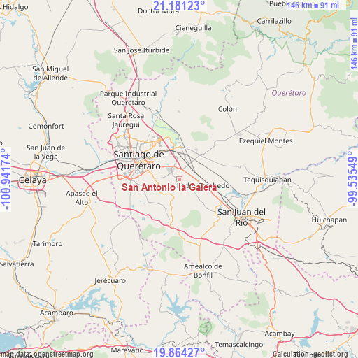
San Antonio la Galera GPS coordinates[2]
20° 31' 27.012" North, 100° 14' 18.996" West
| Map corner | latitude | longitude |
|---|---|---|
| Upper-left | 21.18123°, | -100.94174° |
| Center: | 20.52417°, | -100.23861° |
| Lower-right: | 19.86427°, | -99.53549° |
| Map W x H: | 146.4×146.4 km | = 91×91mi |
| max Lat: | 32.7° ⇑31.7% North |
| San Antonio la Galera: | 20.52417° |
| min Lat: | ⇓68.3% South 14.53588° |
| min Long | San Antonio la | max Long |
| -117.105° | -100.23861° | -86.73105° |
| W 33.2%⇐ | ⇒66.8% E |
Elevation
Elevation of San Antonio la Galera is 1936 m = 6352 ft, and this is 682.3 m = 2239 ft above average elevation for this country.
| Max E: |
3497 m = 11473 ft | 29.5% |
| San Antonio la Galera | 1936 m 6352 ft | |
| Avg. | 1253.7 m = 4113 ft | |
Min E: |
-1 m = -3 ft | 70.5% |
See also: Mexico elevation on elevation.city.
Geographical zone
San Antonio la Galera is located in North Torrid zone (between Equator and Tropic of Cancer). Distance of this Northern Tropic circle is 323.8 km =201.2 mi to North.| Distance of | km | miles | from San Antonio la Galera |
|---|---|---|---|
| North Pole | 7725 | 4800.1 | to North |
| Arctic Circle | 5119.1 | 3180.9 | to North |
| Tropic Cancer | 323.8 | 201.2 | to North |
| Equator | 2282.1 | 1418 | to South |


Nearby cities:
15 places around San Antonio la Galera: (largest is in red/bold)
• Ajuchitlancito
5.9 km =3.7 mi,  156°
156°
• Calamanda
6 km =3.7 mi,  65°
65°
• El Carmen
7.6 km =4.7 mi,  317°
317°
• El Colorado
4.2 km =2.6 mi,  350°
350°
• El Paraíso
5 km =3.1 mi,  27°
27°
• El Rosario
7.3 km =4.5 mi,  270°
270°
• Epigmenio González
8.2 km =5.1 mi, 68°
• General Lázaro Cárdenas (El Colorado)
4.5 km =2.8 mi, 352°
• Guadalupe Primero
8.2 km =5.1 mi,  236°
236°
• La Palma
6.7 km =4.2 mi,  91°
91°
• La Piedad
6.3 km =3.9 mi,  343°
343°
• Los Cues
3.6 km =2.2 mi,  227°
227°
• Palo Alto
2.6 km =1.6 mi,  44°
44°
• San Cristobal (El Colorado)
3.9 km =2.4 mi, 338°
• Santa Teresa
7.3 km =4.5 mi, 243°
Sources, notices
• [Note1] Compared only with cities in Mexico existing in our database
• [Src1] Map data: © OpenStreetMap contributors (CC-BY-SA)
• [Src2] Other city data from geonames.org with taken over terms of usage.
• [Src3] Geographical zone / Annual Mean Temperature by Robert A. Rohde @ Wikipedia
