San Cristobal (El Colorado) geodata
San Cristobal (El Colorado) (Querétaro) is a populated place; located in Mexico in America/Mexico_City (GMT-6) time zone. With population of 751 people, there are 11671 cities with bigger population in this country. Compared to other cities in Mexico, 69% of cities are located further ↓South; 66.9% of cities are located further →East and 70.3% of cities have lower elevation than San Cristobal (El Colorado). Note1
Current local time in San Cristobal (El Colorado):
10:05 AM, MondayDifference from your time zone: hours


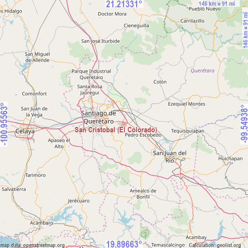
San Cristobal (El Colorado) GPS coordinates[2]
20° 33' 23.004" North, 100° 15' 9" West
| Map corner | latitude | longitude |
|---|---|---|
| Upper-left | 21.21331°, | -100.95563° |
| Center: | 20.55639°, | -100.2525° |
| Lower-right: | 19.89663°, | -99.54938° |
| Map W x H: | 146.4×146.4 km | = 91×91mi |
| max Lat: | 32.7° ⇑31% North |
| San Cristobal (El Colorado): | 20.55639° |
| min Lat: | ⇓69% South 14.53588° |
| min Long | San Cristobal ( | max Long |
| -117.105° | -100.2525° | -86.73105° |
| W 33.1%⇐ | ⇒66.9% E |
Elevation
Elevation of San Cristobal (El Colorado) is 1930 m = 6332 ft, and this is 676.3 m = 2219 ft above average elevation for this country.
| Max E: |
3497 m = 11473 ft | 29.7% |
| San Cristobal (El Colorado) | 1930 m 6332 ft | |
| Avg. | 1253.7 m = 4113 ft | |
Min E: |
-1 m = -3 ft | 70.3% |
See also: Mexico elevation on elevation.city.
Geographical zone
San Cristobal (El Colorado) is located in North Torrid zone (between Equator and Tropic of Cancer). Distance of this Northern Tropic circle is 320.3 km =199 mi to North.| Distance of | km | miles | from San Cristobal (El Colorado) |
|---|---|---|---|
| North Pole | 7721.4 | 4797.9 | to North |
| Arctic Circle | 5115.5 | 3178.6 | to North |
| Tropic Cancer | 320.3 | 199 | to North |
| Equator | 2285.7 | 1420.3 | to South |


Nearby cities:
15 places around San Cristobal (El Colorado): (largest is in red/bold)
• Agua Azul
7.2 km =4.5 mi,  44°
44°
• Calamanda
7 km =4.3 mi,  98°
98°
• Coyotillos
6.6 km =4.1 mi, 43°
• El Carmen
4.2 km =2.6 mi,  298°
298°
• El Colorado
1 km =0.6 mi,  51°
51°
• El Paraíso
3.9 km =2.4 mi,  77°
77°
• El Rosario
6.9 km =4.3 mi,  238°
238°
• General Lázaro Cárdenas (El Colorado)
1.2 km =0.7 mi, 47°
• Jesús María
7.4 km =4.6 mi,  356°
356°
• La Loma
5.1 km =3.2 mi,  16°
16°
• La Piedad
2.5 km =1.6 mi,  352°
352°
• Los Cues
6.2 km =3.9 mi,  191°
191°
• Palo Alto
3.7 km =2.3 mi,  118°
118°
• Paseos del Marqués
5.4 km =3.4 mi,  13°
13°
• San Antonio la Galera
3.9 km =2.4 mi,  158°
158°
Sources, notices
• [Note1] Compared only with cities in Mexico existing in our database
• [Src1] Map data: © OpenStreetMap contributors (CC-BY-SA)
• [Src2] Other city data from geonames.org with taken over terms of usage.
• [Src3] Geographical zone / Annual Mean Temperature by Robert A. Rohde @ Wikipedia
