Guadalupe la Venta geodata
Guadalupe la Venta (Querétaro) is a populated place; located in Mexico in America/Mexico_City (GMT-6) time zone. With population of 937 people, there are 9304 cities with bigger population in this country. Compared to other cities in Mexico, 70.8% of cities are located further ↓South; 66.7% of cities are located further →East and 68.8% of cities have lower elevation than Guadalupe la Venta. Note1


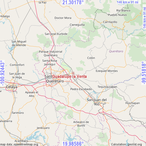
Guadalupe la Venta GPS coordinates[2]
20° 38' 42.864" North, 100° 13' 16.68" West
| Map corner | latitude | longitude |
|---|---|---|
| Upper-left | 21.30178°, | -100.92443° |
| Center: | 20.64524°, | -100.2213° |
| Lower-right: | 19.98586°, | -99.51818° |
| Map W x H: | 146.3×146.3 km | = 90.9×90.9mi |
| max Lat: | 32.7° ⇑29.2% North |
| Guadalupe la Venta: | 20.64524° |
| min Lat: | ⇓70.8% South 14.53588° |
| min Long | Guadalupe la Ve | max Long |
| -117.105° | -100.2213° | -86.73105° |
| W 33.3%⇐ | ⇒66.7% E |
Elevation
Elevation of Guadalupe la Venta is 1903 m = 6243 ft, and this is 649.3 m = 2130 ft above average elevation for this country.
| Max E: |
3497 m = 11473 ft | 31.2% |
| Guadalupe la Venta | 1903 m 6243 ft | |
| Avg. | 1253.7 m = 4113 ft | |
Min E: |
-1 m = -3 ft | 68.8% |
See also: Mexico elevation on elevation.city.
Geographical zone
Guadalupe la Venta is located in North Torrid zone (between Equator and Tropic of Cancer). Distance of this Northern Tropic circle is 310.4 km =192.9 mi to North.| Distance of | km | miles | from Guadalupe la Venta |
|---|---|---|---|
| North Pole | 7711.5 | 4791.7 | to North |
| Arctic Circle | 5105.6 | 3172.5 | to North |
| Tropic Cancer | 310.4 | 192.9 | to North |
| Equator | 2295.5 | 1426.4 | to South |


Nearby cities:
15 places around Guadalupe la Venta: (largest is in red/bold)
• Agua Azul
5 km =3.1 mi,  159°
159°
• Cerrito Colorado
3.7 km =2.3 mi,  232°
232°
• Cerro Prieto
7.2 km =4.5 mi,  273°
273°
• Coyotillos
5.3 km =3.3 mi,  165°
165°
• Galeras
7.3 km =4.5 mi,  114°
114°
• Hacienda la Cruz [Fraccionamiento]
4.5 km =2.8 mi,  252°
252°
• Jesús María
4.4 km =2.7 mi,  235°
235°
• La Griega
3.1 km =1.9 mi,  320°
320°
• La Loma
5.4 km =3.4 mi,  199°
199°
• La Trinidad
7.8 km =4.8 mi,  260°
260°
• Paseos del Marqués
5 km =3.1 mi, 203°
• Saldarriaga
7.7 km =4.8 mi, 255°
• Santa Fe Libertadores
4.6 km =2.9 mi,  297°
297°
• Santa María Ticomán
5.2 km =3.2 mi, 302°
• Viborillas
5.5 km =3.4 mi,  137°
137°
Sources, notices
• [Note1] Compared only with cities in Mexico existing in our database
• [Src1] Map data: © OpenStreetMap contributors (CC-BY-SA)
• [Src2] Other city data from geonames.org with taken over terms of usage.
• [Src3] Geographical zone / Annual Mean Temperature by Robert A. Rohde @ Wikipedia
