Rancho Largo geodata
Rancho Largo (Querétaro) is a populated place; located in Mexico in America/Mexico_City (GMT-6) time zone. With population of 575 people, there are 14908 cities with bigger population in this country. Compared to other cities in Mexico, 71.7% of cities are located further ↓South; 68.9% of cities are located further →East and 69.9% of cities have lower elevation than Rancho Largo. Note1


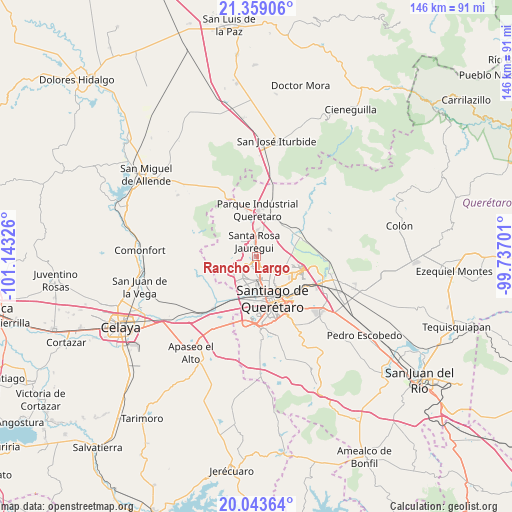
Rancho Largo GPS coordinates[2]
20° 42' 10.008" North, 100° 26' 24.468" West
| Map corner | latitude | longitude |
|---|---|---|
| Upper-left | 21.35906°, | -101.14326° |
| Center: | 20.70278°, | -100.44013° |
| Lower-right: | 20.04364°, | -99.73701° |
| Map W x H: | 146.3×146.3 km | = 90.9×90.9mi |
| max Lat: | 32.7° ⇑28.3% North |
| Rancho Largo: | 20.70278° |
| min Lat: | ⇓71.7% South 14.53588° |
| min Long | Rancho Largo | max Long |
| -117.105° | -100.44013° | -86.73105° |
| W 31.1%⇐ | ⇒68.9% E |
Elevation
Elevation of Rancho Largo is 1922 m = 6306 ft, and this is 668.3 m = 2193 ft above average elevation for this country.
| Max E: |
3497 m = 11473 ft | 30.1% |
| Rancho Largo | 1922 m 6306 ft | |
| Avg. | 1253.7 m = 4113 ft | |
Min E: |
-1 m = -3 ft | 69.9% |
See also: Mexico elevation on elevation.city.
Geographical zone
Rancho Largo is located in North Torrid zone (between Equator and Tropic of Cancer). Distance of this Northern Tropic circle is 304 km =188.9 mi to North.| Distance of | km | miles | from Rancho Largo |
|---|---|---|---|
| North Pole | 7705.1 | 4787.7 | to North |
| Arctic Circle | 5099.2 | 3168.5 | to North |
| Tropic Cancer | 304 | 188.9 | to North |
| Equator | 2301.9 | 1430.3 | to South |


Nearby cities:
15 places around Rancho Largo: (largest is in red/bold)
• Acequia Blanca
3.4 km =2.1 mi,  303°
303°
• Bosques de la Hacienda
6.2 km =3.9 mi,  156°
156°
• Ejido San Pablo
5 km =3.1 mi,  146°
146°
• El Nabo
4.3 km =2.7 mi,  256°
256°
• El Salitre
4.5 km =2.8 mi, 156°
• Hacienda Santa Rosa [Fraccionamiento]
7.1 km =4.4 mi,  1°
1°
• Juriquilla
2 km =1.2 mi, 304°
• La Solana
6.2 km =3.9 mi,  50°
50°
• Mompaní
7 km =4.3 mi, 260°
• Montenegro
6.8 km =4.2 mi,  10°
10°
• Paseos del Pedregal
6.1 km =3.8 mi,  134°
134°
• San José Buenavista
4.7 km =2.9 mi,  41°
41°
• Santa Rosa Jauregui
4.4 km =2.7 mi,  348°
348°
• Sergio Villaseñor
6.7 km =4.2 mi, 162°
• Villas Fontana [Fraccionamiento]
5.9 km =3.7 mi,  144°
144°
Sources, notices
• [Note1] Compared only with cities in Mexico existing in our database
• [Src1] Map data: © OpenStreetMap contributors (CC-BY-SA)
• [Src2] Other city data from geonames.org with taken over terms of usage.
• [Src3] Geographical zone / Annual Mean Temperature by Robert A. Rohde @ Wikipedia
