San Román geodata
San Román (Quintana Roo) is a populated place; located in Mexico in America/Cancun (GMT-5) time zone. With population of 530 people, there are 15970 cities with bigger population in this country. Compared to other cities in Mexico, 68.8% of cities are located further ↑North; 99% of cities are located further ←West and 80.3% of cities have higher elevation than San Román. Note1


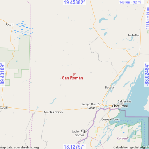
San Román GPS coordinates[2]
18° 47' 40.236" North, 88° 43' 40.656" West
| Map corner | latitude | longitude |
|---|---|---|
| Upper-left | 19.45882°, | -89.43109° |
| Center: | 18.79451°, | -88.72796° |
| Lower-right: | 18.12757°, | -88.02484° |
| Map W x H: | 148×148 km | = 92×92mi |
| max Lat: | 32.7° ⇑68.8% North |
| San Román: | 18.79451° |
| min Lat: | ⇓31.2% South 14.53588° |
| min Long | San Román | max Long |
| -117.105° | -88.72796° | -86.73105° |
| W 99%⇐ | ⇒1% E |
Elevation
Elevation of San Román is 91 m = 299 ft, and this is 1162.7 m = 3815 ft below average elevation for this country.
| Max E: |
3497 m = 11473 ft | 80.3% |
| Avg. | 1253.7 m = 4113 ft | |
| San Román | 91 m = 299 ft | |
Min E: |
-1 m = -3 ft | 19.7% |
See also: Mexico elevation on elevation.city.
Geographical zone
San Román is located in North Torrid zone (between Equator and Tropic of Cancer). Distance of this Northern Tropic circle is 516.2 km =320.8 mi to North.| Distance of | km | miles | from San Román |
|---|---|---|---|
| North Pole | 7917.3 | 4919.6 | to North |
| Arctic Circle | 5311.4 | 3300.3 | to North |
| Tropic Cancer | 516.2 | 320.8 | to North |
| Equator | 2089.8 | 1298.5 | to South |


Nearby cities:
15 places around San Román: (largest is in red/bold)
• Altos de Sevilla
8.3 km =5.2 mi,  40°
40°
• Bacalar
37.4 km =23.2 mi,  109°
109°
• Carlos A. Madrazo
38.9 km =24.2 mi,  146°
146°
• Francisco Villa
37.2 km =23.1 mi,  199°
199°
• Jesús González Ortega
34.7 km =21.6 mi,  169°
169°
• Lázaro Cárdenas Segundo
17.2 km =10.7 mi,  232°
232°
• Maya Balam
38.1 km =23.7 mi,  65°
65°
• Morocoy
23 km =14.3 mi, 202°
• Nachi Cocom
34.7 km =21.6 mi,  184°
184°
• Reforma
16.5 km =10.3 mi,  82°
82°
• Salamanca
30 km =18.6 mi,  116°
116°
• San Isidro la Laguna
37.7 km =23.4 mi,  87°
87°
• San Pedro Peralta
17.1 km =10.6 mi, 232°
• Sergio Butrón Casas
35.4 km =22 mi, 151°
• Xul-Ha
38.8 km =24.1 mi,  134°
134°
Sources, notices
• [Note1] Compared only with cities in Mexico existing in our database
• [Src1] Map data: © OpenStreetMap contributors (CC-BY-SA)
• [Src2] Other city data from geonames.org with taken over terms of usage.
• [Src3] Geographical zone / Annual Mean Temperature by Robert A. Rohde @ Wikipedia
