Morocoy geodata
Morocoy (Quintana Roo) is a populated place; located in Mexico in America/Cancun (GMT-5) time zone. With population of 1,293 people, there are 6703 cities with bigger population in this country. Compared to other cities in Mexico, 71.4% of cities are located further ↑North; 98.9% of cities are located further ←West and 81.7% of cities have higher elevation than Morocoy. Note1


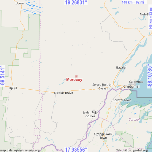
Morocoy GPS coordinates[2]
18° 36' 11.664" North, 88° 48' 39.492" West
| Map corner | latitude | longitude |
|---|---|---|
| Upper-left | 19.26831°, | -89.5141° |
| Center: | 18.60324°, | -88.81097° |
| Lower-right: | 17.93556°, | -88.10785° |
| Map W x H: | 148.2×148.2 km | = 92.1×92.1mi |
| max Lat: | 32.7° ⇑71.4% North |
| Morocoy: | 18.60324° |
| min Lat: | ⇓28.6% South 14.53588° |
| min Long | Morocoy | max Long |
| -117.105° | -88.81097° | -86.73105° |
| W 98.9%⇐ | ⇒1.1% E |
Elevation
Elevation of Morocoy is 73 m = 240 ft, and this is 1180.7 m = 3874 ft below average elevation for this country.
| Max E: |
3497 m = 11473 ft | 81.7% |
| Avg. | 1253.7 m = 4113 ft | |
| Morocoy | 73 m = 240 ft | |
Min E: |
-1 m = -3 ft | 18.3% |
See also: Mexico elevation on elevation.city.
Geographical zone
Morocoy is located in North Torrid zone (between Equator and Tropic of Cancer). Distance of this Northern Tropic circle is 537.4 km =333.9 mi to North.| Distance of | km | miles | from Morocoy |
|---|---|---|---|
| North Pole | 7938.6 | 4932.8 | to North |
| Arctic Circle | 5332.7 | 3313.6 | to North |
| Tropic Cancer | 537.4 | 333.9 | to North |
| Equator | 2068.5 | 1285.3 | to South |


Nearby cities:
15 places around Morocoy: (largest is in red/bold)
• Altos de Sevilla
31 km =19.3 mi,  27°
27°
• Caobas
35.6 km =22.1 mi,  240°
240°
• Carlos A. Madrazo
32.2 km =20 mi,  110°
110°
• Francisco Villa
14.3 km =8.9 mi,  194°
194°
• Jesús González Ortega
19.7 km =12.2 mi,  130°
130°
• Lázaro Cárdenas Segundo
12 km =7.5 mi,  335°
335°
• Nachi Cocom
14.8 km =9.2 mi,  154°
154°
• Nicolás Bravo
20.2 km =12.6 mi,  217°
217°
• Palmar
34.3 km =21.3 mi,  120°
120°
• Reforma
34.3 km =21.3 mi,  47°
47°
• Sacxán
34.4 km =21.4 mi, 116°
• San Pedro Peralta
11.8 km =7.3 mi, 336°
• San Román
23 km =14.3 mi,  22°
22°
• Sergio Butrón Casas
27.4 km =17 mi, 111°
• Ucum
32.8 km =20.4 mi, 109°
Sources, notices
• [Note1] Compared only with cities in Mexico existing in our database
• [Src1] Map data: © OpenStreetMap contributors (CC-BY-SA)
• [Src2] Other city data from geonames.org with taken over terms of usage.
• [Src3] Geographical zone / Annual Mean Temperature by Robert A. Rohde @ Wikipedia
