Lázaro Cárdenas Segundo geodata
Lázaro Cárdenas Segundo (Quintana Roo) is a populated place; located in Mexico in America/Cancun (GMT-5) time zone. With population of 699 people, there are 12460 cities with bigger population in this country. Compared to other cities in Mexico, 70.2% of cities are located further ↑North; 98.9% of cities are located further ←West and 77.3% of cities have higher elevation than Lázaro Cárdenas Segundo. Note1
Current local time in Lázaro Cárdenas Segundo:
07:52 AM, WednesdayDifference from your time zone: hours


Lázaro Cárdenas Segundo GPS coordinates[2]
18° 42' 4.428" North, 88° 51' 29.592" West
| Map corner | latitude | longitude |
|---|---|---|
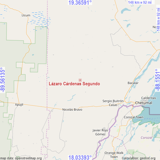
| Upper-left | 19.36591°, | -89.56135° |
| Center: | 18.70123°, | -88.85822° |
| Lower-right: | 18.03393°, | -88.1551° |
| Map W x H: | 148.1×148.1 km | = 92×92mi |
| max Lat: | 32.7° ⇑70.2% North |
| Lázaro Cárdenas Segundo: | 18.70123° |
| min Lat: | ⇓29.8% South 14.53588° |
| min Long | Lázaro Cárden | max Long |
| -117.105° | -88.85822° | -86.73105° |
| W 98.9%⇐ | ⇒1.1% E |
Elevation
Elevation of Lázaro Cárdenas Segundo is 146 m = 479 ft, and this is 1107.7 m = 3634 ft below average elevation for this country.
| Max E: |
3497 m = 11473 ft | 77.3% |
| Avg. | 1253.7 m = 4113 ft | |
| Lázaro Cárdenas Segundo | 146 m = 479 ft | |
Min E: |
-1 m = -3 ft | 22.7% |
See also: Mexico elevation on elevation.city.
Geographical zone
Lázaro Cárdenas Segundo is located in North Torrid zone (between Equator and Tropic of Cancer). Distance of this Northern Tropic circle is 526.5 km =327.2 mi to North.| Distance of | km | miles | from Lázaro Cárdenas Segundo |
|---|---|---|---|
| North Pole | 7927.7 | 4926 | to North |
| Arctic Circle | 5321.8 | 3306.8 | to North |
| Tropic Cancer | 526.5 | 327.2 | to North |
| Equator | 2079.4 | 1292.1 | to South |


Nearby cities:
15 places around Lázaro Cárdenas Segundo: (largest is in red/bold)
• Altos de Sevilla
25.4 km =15.8 mi,  48°
48°
• Caobas
38.6 km =24 mi,  222°
222°
• Carlos A. Madrazo
41.5 km =25.8 mi,  122°
122°
• Francisco Villa
24.8 km =15.4 mi,  176°
176°
• Jesús González Ortega
31 km =19.3 mi,  140°
140°
• Miguel Alemán
34.2 km =21.3 mi,  313°
313°
• Morocoy
12 km =7.5 mi,  155°
155°
• Nachi Cocom
26.8 km =16.7 mi, 155°
• Nicolás Bravo
27.9 km =17.3 mi,  195°
195°
• Nuevo Becar
28.8 km =17.9 mi,  275°
275°
• Reforma
32.6 km =20.3 mi,  67°
67°
• Salamanca
40.7 km =25.3 mi,  94°
94°
• San Pedro Peralta
0.2 km =0.1 mi,  104°
104°
• San Román
17.2 km =10.7 mi, 52°
• Sergio Butrón Casas
36.9 km =22.9 mi, 124°
Sources, notices
• [Note1] Compared only with cities in Mexico existing in our database
• [Src1] Map data: © OpenStreetMap contributors (CC-BY-SA)
• [Src2] Other city data from geonames.org with taken over terms of usage.
• [Src3] Geographical zone / Annual Mean Temperature by Robert A. Rohde @ Wikipedia
