Oriente Medio Día geodata
Oriente Medio Día (Veracruz) is a populated place; located in Mexico in America/Mexico_City (GMT-6) time zone. With population of 507 people, there are 16589 cities with bigger population in this country. Compared to other cities in Mexico, 63% of cities are located further ↓South; 69.7% of cities are located further ←West and 81.6% of cities have higher elevation than Oriente Medio Día. Note1


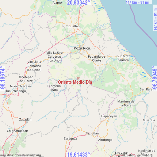
Oriente Medio Día GPS coordinates[2]
20° 16' 31.008" North, 97° 29' 0.996" West
| Map corner | latitude | longitude |
|---|---|---|
| Upper-left | 20.93342°, | -98.18674° |
| Center: | 20.27528°, | -97.48361° |
| Lower-right: | 19.61433°, | -96.78049° |
| Map W x H: | 146.7×146.7 km | = 91.2×91.2mi |
| max Lat: | 32.7° ⇑37% North |
| Oriente Medio Día: | 20.27528° |
| min Lat: | ⇓63% South 14.53588° |
| min Long | Oriente Medio D | max Long |
| -117.105° | -97.48361° | -86.73105° |
| W 69.7%⇐ | ⇒30.3% E |
Elevation
Elevation of Oriente Medio Día is 74 m = 243 ft, and this is 1179.7 m = 3870 ft below average elevation for this country.
| Max E: |
3497 m = 11473 ft | 81.6% |
| Avg. | 1253.7 m = 4113 ft | |
| Oriente Medio Día | 74 m = 243 ft | |
Min E: |
-1 m = -3 ft | 18.4% |
See also: Mexico elevation on elevation.city.
Geographical zone
Oriente Medio Día is located in North Torrid zone (between Equator and Tropic of Cancer). Distance of this Northern Tropic circle is 351.5 km =218.4 mi to North.| Distance of | km | miles | from Oriente Medio Día |
|---|---|---|---|
| North Pole | 7752.7 | 4817.3 | to North |
| Arctic Circle | 5146.8 | 3198.1 | to North |
| Tropic Cancer | 351.5 | 218.4 | to North |
| Equator | 2254.4 | 1400.8 | to South |


Nearby cities:
15 places around Oriente Medio Día: (largest is in red/bold)
• Buenavista
3.2 km =2 mi,  317°
317°
• Comalteco
3.2 km =2 mi,  156°
156°
• El Arenal
4.2 km =2.6 mi,  231°
231°
• El Chacal
6.4 km =4 mi, 157°
• El Ermitaño
8.1 km =5 mi,  200°
200°
• Entabladero
7 km =4.3 mi,  269°
269°
• José María Morelos
8.7 km =5.4 mi,  53°
53°
• La Noria
8.1 km =5 mi, 270°
• Ojite de Matamoros
2.9 km =1.8 mi, 203°
• Oriente Meridiano
1.4 km =0.9 mi,  348°
348°
• Poza Larga Zapotal
5.7 km =3.5 mi,  8°
8°
• Sabanas de Xalostoc
8 km =5 mi,  222°
222°
• Sabanita
7.5 km =4.7 mi,  261°
261°
• Santa Catarina y Ciruelo
3.5 km =2.2 mi, 14°
• Zacate Limón
7 km =4.3 mi, 217°
Sources, notices
• [Note1] Compared only with cities in Mexico existing in our database
• [Src1] Map data: © OpenStreetMap contributors (CC-BY-SA)
• [Src2] Other city data from geonames.org with taken over terms of usage.
• [Src3] Geographical zone / Annual Mean Temperature by Robert A. Rohde @ Wikipedia
